Skip to content
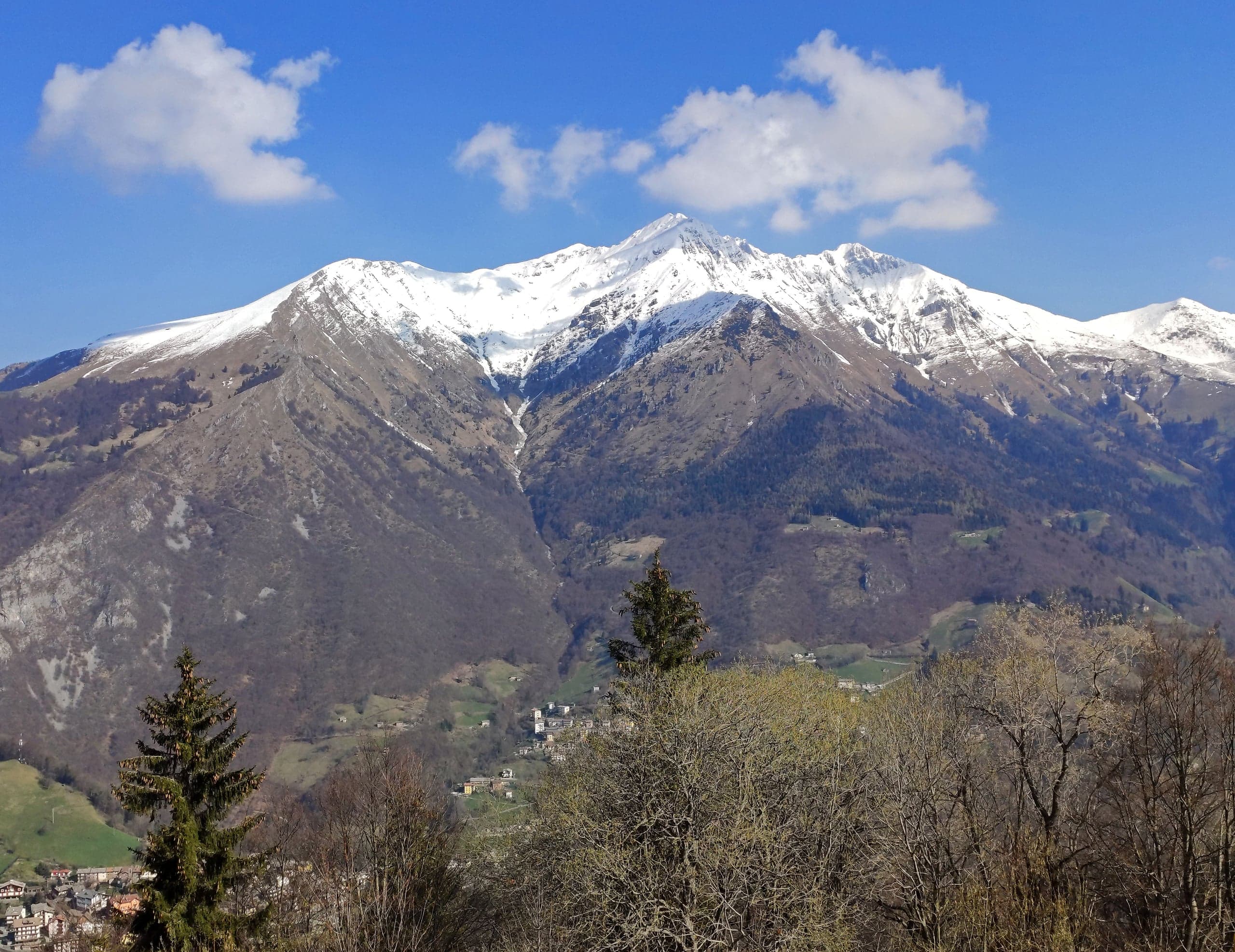
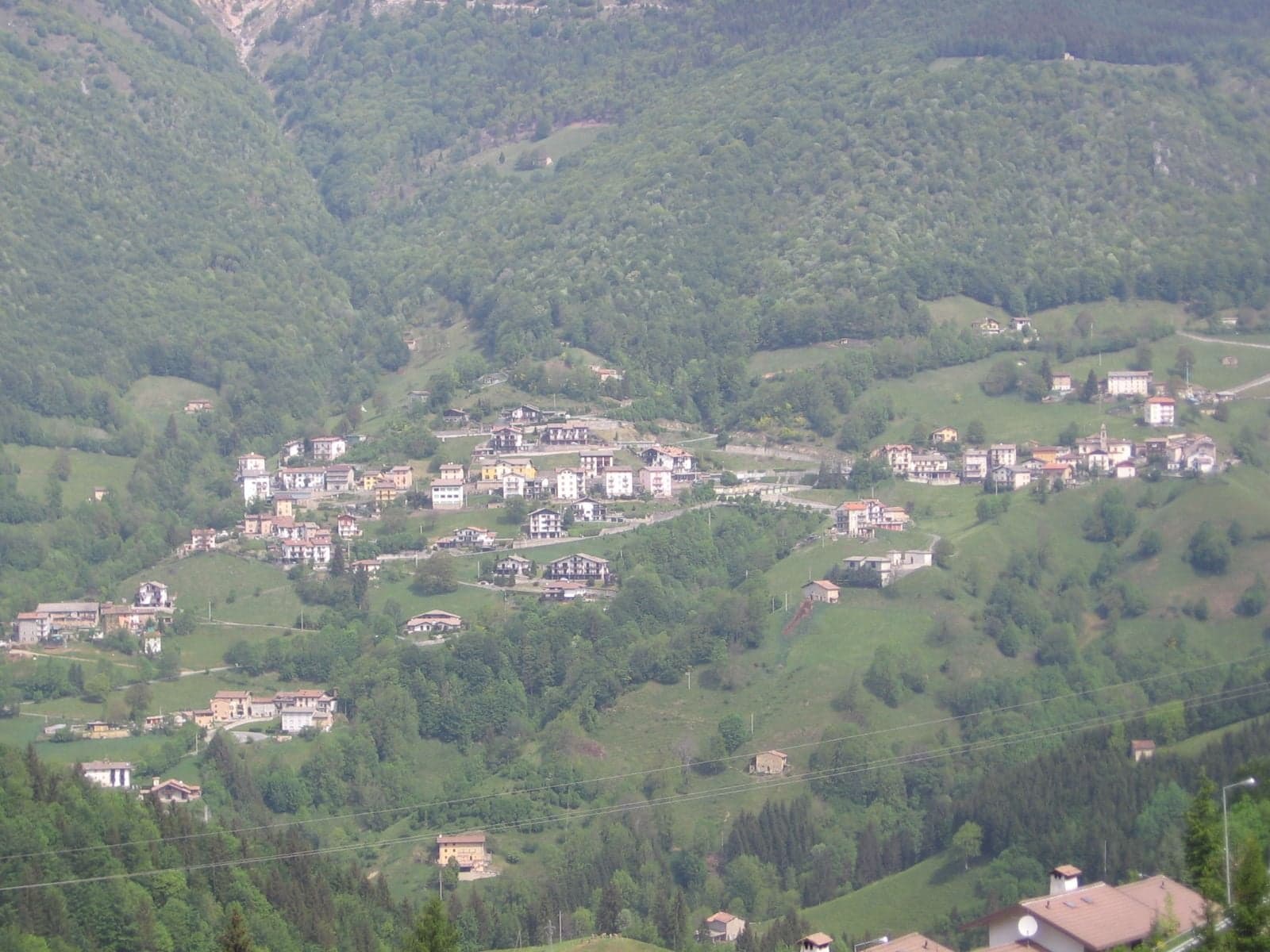
The houses of Zorzone, a hamlet of Oltre il Colle, lined up among the meadows and woods of the slope

Hamlet of Oltre il Colle · Val Serina

Zorzone

Zorzone, the mining hamlet of Oltre il Colle at 1,016 m below Cima di Menna: the mining museum, the Caniana church, CAI trails, parking and climate.

Elevation1,016 m a.s.l.
Inhabitants (2021)193
MunicipalityOltre il Colle (BG)
Postcode24013

Zorzone (Zùrzù in Bergamo dialect) is the northernmost settlement of the municipality of Oltre il Colle: a shelf of meadows at the foot of Cima di Menna, with the Parina stream flowing below and giving its name to Val Parina. The houses huddle around the church; at the 2021 census there were 193 residents, in 86 households. Sources disagree on the elevation: ISTAT and the maps give 1,016 metres, CAI Bergamo 1,019 for the start of its trails, the Pro Loco 1,100 and the old provincial tourism portal 1,050, differences that depend on the point taken as reference in a settlement that is all on a slope.

Zorzone is the place where the mining history of the basin can be touched. Above the village, towards Val Vedra, opened the mine considered the main zinc mine of the Orobie, with the Malanotte and Pian di Bracca workings. Calamine, sphalerite and galena were extracted, yielding zinc, lead and small quantities of silver, and the complex was not isolated: according to a reconstruction published by Prima Bergamo, a 340-metre shaft and a 12-kilometre tunnel linked Pian di Bracca to the Gorno workings, on the other side of the mountain in the Seriana valley. The mines closed for good in 1982 and the tunnels cannot be visited.

That memory is gathered in the Museum of Minerals and Mining, which the Pro Loco calls the «Franco Palazzi» Museum of Mining and Minerals. It is housed in via Funivia, in the former primary school building, and opened in 1994, although a collection had existed since 1970 in a private room. It occupies three floors: on the ground floor the mining section, with panels, tools and a life-size reconstruction of a tunnel entrance; on the first floor about 500 local finds, 1,600 minerals from all over the world and 450 fossils; on the second the multimedia area with the meeting room and the Lady Irene Memorial, dedicated to the crew of the B24 bomber that crashed in 1944 on the Pezzadello, just below the Menna ridge.

The parish church is dedicated to the Holy Trinity, patron of the hamlet. Zorzone obtained its parish on 24 September 1636 by decree of bishop Luigi Grimani and the building of that time was consecrated on 21 June 1644; the church you see today is the rebuilding begun in 1745 to a design by Giovan Battista Caniana and completed in the following decade, with the 1795 altar made by the Palazzi family and the evangelists painted on the pendentives of the dome by Umberto Marigliani in 1911.

For walkers, Zorzone is a real starting point and not a place you pass through. From here CAI trail 234 climbs through Val Carnera to the MAGA bivouac and Cima di Menna (2,299 m according to the CAI); trail 231 climbs Val Vedra to the Passo Branchino; trail 259 descends Val Parina, a special area of conservation in the Natura 2000 network, down to the Brembo. In the hamlet services are reduced to the essentials, a grocery with a tobacconist's counter and the museum; for the pharmacy, petrol station and offices you go down to the main village, less than five kilometres away.

The houses of Zorzone gathered around the bell tower of the church of the Santissima Trinità on a January day, below snowy slopes
Zorzone in January, with the bell tower of the Santissima Trinità
Photo: Ago76 · CC BY-SA 3.0

Elevation and location

Zorzone's elevations diverge more than those of the other hamlets. ISTAT, in the localities of the 2011 and 2021 censuses, and the OpenStreetMap node give 1,016 metres; CAI Bergamo starts its trails at 1,019 metres; the Pro Loco writes 1,100 metres and the provincial tourism portal, now offline, wrote 1,050. The elevation model used by Open-Meteo gives about 1,025 metres in front of the church.

Zorzone is not on the provincial road. From the main village you leave the SP27 in via Roma, at the Piazzale degli Alpini, and take the municipal road of via Capriana, which climbs north through the meadows: from piazza Tiraboschi to the church it is about 4.8 kilometres and ten minutes or so. It is a narrow, winding road, to be driven without hurry. From the Colle di Zambla the route is about 10 kilometres, because you first have to go down to the main village.

Where the name comes from

In Bergamo dialect the village is called Zùrzù, the form recorded by the Dizionario italiano-bergamasco by Carmelo Francia and Emanuele Gambarini, and the inhabitants are zorzonesi. On the origin of the name, the Wikipedia article reports that the most accepted theory links it to the Zorzi, one of the most important local families, and considers a derivation from «Giorgione» less likely; the article, however, gives no source, and none of the sources consulted for this guide documents either hypothesis.

Hamlets and outlying settlements

The village gathers around the church, and its streets bear names such as via Funivia, the museum road, via Gasparelli, via Scolari, via Giorgi, via Colombi, via Pascusa, via San Rocco and via Santissima Trinità. The S50e shuttle has a stop at contrada Santi, at the entrance to the village. To the north-east, along Val Vedra, ISTAT counts a cluster of its own, Piani Bracca, at 1,110 metres: four residents and five dwellings in 2021. CAI Bergamo calls it Pian Bracca and notes that today it is the most used starting point for Val Vedra, because you can drive there from Zorzone.

Other names worth knowing are on the trails: the Mattuida farmstead, at 1,470 metres on trail 234 towards the Menna; the small chapel of Petta, a viewpoint at the start of trail 259 into Val Parina, which Wikipedia calls the chapel of Peta and says is dedicated to the Madonna della Gamba; Ca Pasì, a place with a farmstead and the entrance of a mine used for hauling material, remembered in a testimony collected by Prima Bergamo. Above the village, on the Menna ridge, the OpenStreetMap map marks Cima di Zorzone, at 2,050 metres, with a cross.

The mines: what remains and what you can see

According to the reconstruction published by Prima Bergamo in 2019, the mines of Oltre il Colle were divided into three zones: Val Vedra above Zorzone, with the Pian di Bracca mine laid out on three levels; the Arera, where from the nineteenth century an open-pit site called «Luna» was also worked; and Val Parina with the slopes of Monte Plassa. The whole complex along the Val Parina, Val del Riso and Val Vedra axis is estimated at almost 250 kilometres of tunnels. The Val Vedra mines were reopened one last time in 1970 and closed in 1982; the 1980 found in some sources is the date given by the museum's curator and by the Comunità Montana.

The tunnels are closed today and cannot be visited: near the Piani di Bracca a large entrance remains, overgrown with vegetation and barred by a gate. To go inside a mine you need to visit the show mines of Dossena or Gorno. At the Zorzone museum the mining section opens with a depiction of the Arera that the museum attributes to Leonardo da Vinci, taken from sheet 12410 of the Royal Collection at Windsor, with the hypothesis that the artist visited the basin between 1506 and 1507; then tools, a pneumatic loader on rails, the «pachèra», the workers' wagon, the «carèl», pay slips, work booklets and a panel dedicated to St Barbara, patron saint of miners.

The mining question, meanwhile, is not closed. In 2022 the Ministry of Ecological Transition issued a negative environmental compatibility ruling on the reopening of the zinc and lead mines requested by Energia Minerals, part of the Australian group Altamin, in Gorno, Oltre il Colle and Oneta. In February 2026, according to L'Eco di Bergamo, the Ministry of the Environment instead gave a favourable opinion, with conditions, on the retrospective environmental impact assessment of the exploration drilling carried out without authorisation by Vedra Metals, the group company working in the area: exploration could resume within the year, while any extraction will require a new authorisation process.

The trails that start from the village

Zorzone's three classic routes are numbered trails of CAI Bergamo, with data published on the section's geoportal. All three are graded E, hiking trails, and the recommended period for 234 and 231 runs from April to October; 259 is given as passable all year, but it has exposed sections with fixed aids.

  • CAI 234, Zorzone – MAGA bivouac – Monte Menna: from the start at 1,019 metres you climb Val Carnera, pass the Mattuida farmstead (1,470 m) and reach the MAGA bivouac (2,005 m), then along a spur and the ridge to the summit (2,299 m). About 4.8 kilometres and 1,250 metres of ascent, 4 hours up and 2 hours 15 down.
  • CAI 231, Zorzone – Passo Branchino: a mule track contouring towards Val Vedra, then Pian Bracca (1,111 m), the Pessel hut (1,209 m), the Vedro dairy hut (1,672 m), the Val Vedra pass (1,848 m) and the Passo Branchino (1,821 m). About 7.6 kilometres and 850 metres of ascent, 3 hours out and 2 hours 10 back.
  • CAI 259, Val Parina – Scalvino (Lenna): it starts just before Zorzone, near the Serbaplast works, passes the small chapel of Petta and the meadows of Prà Parina and descends one of the wildest valleys in the Bergamo area to the confluence with the Brembo, where bridges and tunnels of the old railway remain; about 12 kilometres and four and a half hours to Scalvino.

Where to park

CAI Bergamo gives a different car park for each trail: via Colombi for 234 towards the Menna, via Giorgi for 231 towards Val Vedra and via Scolari for 259 into Val Parina. OpenStreetMap maps in the village a car park of about a thousand square metres between via Giorgi and via Teggiolo, a smaller one at the entrance between via Santi and via Gasparelli and one in via Colombi; a yard next to the church is marked as not open to the public.

Those heading into Val Vedra can drive up to Pian Bracca, as the CAI points out, and shorten the walk. In the village the streets are narrow: it is better to leave the car in the car parks and not along the roads.

What's in the village: shops, services and buses

Zorzone has a grocery with a tobacconist's counter, in via Pascusa, and the museum. Bars, restaurants, the pharmacy, bank, post office and petrol station are in the main village, 4.8 kilometres away; hotels, B&Bs and campsites mostly in Zambla Alta. The pages with addresses and phone numbers are under Food and services.

Without a car you arrive on Arriva's S50e shuttle, Oltre il Colle – Zorzone, which leaves from piazza Tiraboschi and in a quarter of an hour calls at via Capriana, contrada Santi, via Gasparelli and piazza Caduti del Lavoro. In the timetable in force from 14 September 2026 to 8 June 2027 there are seven services each way Monday to Friday, one of them on school days only, and five on Saturdays; the first leaves the main village at 6:25, the last at 18:10, and the timetable shows the connections with line B to Zogno and Bergamo. On Sundays and public holidays the shuttle does not run; in summer 2026 there were two services each way.

How many people live here: population over time

The municipality publishes only the total number of residents; for the hamlets the figures come from the censuses, which ISTAT processes by inhabited locality. In 2011 Zorzone had 215 residents in 82 households, in 2021 193 residents in 86 households: fewer people but more households, a sign of smaller families. Over the same period the municipality fell from 1,058 to 980 inhabitants. Locality boundaries shift a little from one census to the next, so the comparison is indicative.

Compared with the other hamlets, Zorzone has fewer empty houses: in 2011 dwellings occupied by residents were 82 out of 260, almost one in three, against one in eight in Zambla Alta. The age of the houses tells a different story too: more than a third of the residential buildings counted in 2011 were built between 1919 and 1960, when the mines were still working.

  • 2011 census: 215 residents in 82 households; 260 dwellings, 82 of them occupied by residents
  • 2021 census: 193 residents in 86 households; 290 dwellings and 109 buildings
  • Residential buildings by period, 2011 census: 22 before 1919, 33 between 1919 and 1960, 24 between 1961 and 1980, 13 between 1981 and 2000, none after 2000

How cold it gets: the climate month by month

The historical research of Massimo Maurizio, published by the Blog della Valserina, speaks of «sunny Zorzone» in contrast with the cold of the main village: exposure matters, and a coarse-grid climate model does not capture it. The averages below were worked out by this guide from the 1991-2020 daily data of Copernicus's ERA5 reanalysis, downloaded from the Open-Meteo historical archive: temperatures from ERA5-Land (0.1°, about 10 kilometres) adjusted to the elevation of about 985 metres at the point of the coordinates, precipitation and snow from the 0.25° ERA5 grid, about 25 kilometres, the same for the whole basin.

The picture: about 130 frost nights a year, average lows below zero from December to March, average highs of 22 degrees in July and August, about 2,000 millimetres of precipitation and about two metres of fresh snow in an average season. These are reanalysis estimates, not measurements: a finer regional reanalysis, CERRA (5.5 kilometres), gives the basin milder winters and more precipitation.

Monthly averages 1991-2020 (ERA5 reanalysis)

MonthLowHighPrecipitationFresh snow
January−7 °C3 °C70 mmabout 40 cm
February−6 °C4 °C70 mmabout 40 cm
March−2 °C8 °C100 mmabout 35 cm
April1 °C11 °C170 mmabout 25 cm
May6 °C16 °C210 mmrare (about 5 cm)
June10 °C20 °C230 mm—
July12 °C22 °C230 mm—
August12 °C22 °C240 mm—
September9 °C17 °C190 mm—
October5 °C13 °C200 mmrare (about 5 cm)
November0 °C8 °C180 mmabout 25 cm
December−5 °C4 °C90 mmabout 40 cm

Estimates from the Copernicus ERA5 reanalysis worked out by this guide from Open-Meteo data: not measurements from a weather station. Snow is the fresh snowfall in the month, not the depth on the ground.

When to go

For the trails, the period is the one given by the CAI, April to October for 234 and 231, while 259 in Val Parina is given as passable all year. The museum, according to the Comunità Montana Valle Brembana, opens on the afternoons of Sundays and public holidays all year round and from 1 to 20 August: it is the right outing for a rainy day.

The village's festivals, fairs and races are on the Events page. In winter the via Capriana road is municipal and narrow, and on the provincial roads up to the basin winter tyres or chains on board are compulsory from 15 November to 15 April.

Not to be missed

What to see in Zorzone

  1. Museum of Minerals and Mining

    At via Funivia 101, in the former primary school, opened in 1994. Three floors: the mining section with tools and a life-size reconstruction of a tunnel entrance, then about 500 local finds, 1,600 minerals from around the world and 450 fossils, and finally the multimedia area with the Lady Irene Memorial. The Comunità Montana gives a ticket price of 1.50 euros, free up to the age of 12.

  2. Parish church of the Santissima Trinità

    A parish since 24 September 1636, rebuilt from 1745 to a design by Giovan Battista Caniana. Altar of 1795 by the Palazzi family, who held the right of patronage, evangelists on the pendentives of the dome painted by Umberto Marigliani in 1911, statues of St Roch and St Agnes, and a baptistery with a red marble font under a small temple-shaped cover.

  3. The Lady Irene Memorial

    Set up inside the museum, it commemorates the crew of the B24 bomber «Lady Irene» that crashed in 1944 on the Pezzadello, just below the ridge of Monte Menna. It preserves relics of the aircraft, including kitchen utensils made from its sheet metal.

  4. Val Vedra and the Pian di Bracca workings

    Above the village opened what was considered the main zinc mine of the Orobie, with the Malanotte and Pian di Bracca workings. The tunnels are closed and cannot be visited, but CAI trail 231 climbs the valley past Pian Bracca, where a large barred entrance remains, up to the Passo Branchino.

  5. Val Parina

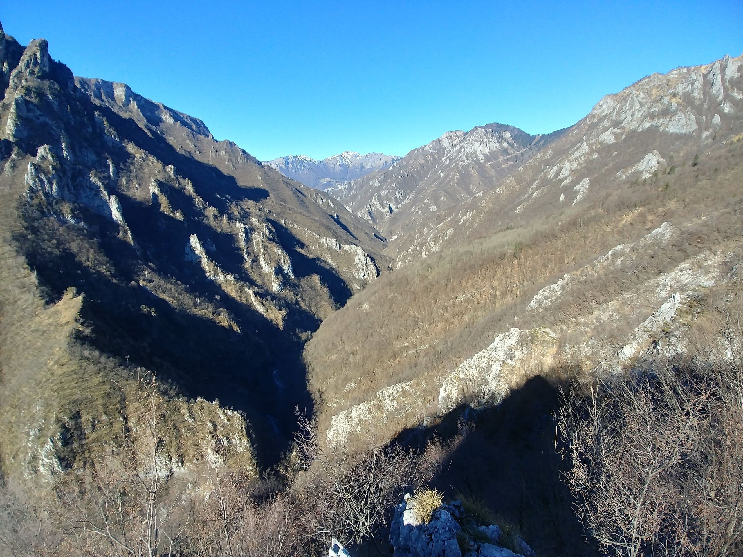
    Below the village flows the Parina stream, in one of the wildest and least visited valleys of the Bergamo area. It is a special area of conservation in the Natura 2000 network (IT2060008, 2,225 hectares between 470 and 2,299 metres) within the Orobie Bergamasche Park, with gorge woodland, black grouse and nesting golden eagles. CAI trail 259 runs through it.

  6. Start of CAI trail 234 to Cima di Menna

    CAI Bergamo advises parking in via Colombi. Trail 234 climbs Val Carnera to the Mattuida farmstead and the MAGA bivouac (2,005 m), then along a spur and the ridge reaches the summit at 2,299 metres: about 1,250 metres of ascent and 4 hours of climbing. It is the normal route up the mountain that closes the basin to the north.

History

The history of Zorzone

Zorzone grew with its mines. The first communities of the upper Val Serina are perhaps linked to the extraction of iron and zinc on the slopes of the Menna and Arera, according to the municipality's historical record on Lombardia Beni Culturali, and in the sixteenth century Zorzone was one of the five colonnelli (districts) into which the municipality of Oltre il Colle was divided, together with San Bartolomeo, Valpiana, Zambla Alta and Zambla Bassa. On 24 September 1636 the church of the Holy Trinity was made an independent parish, and in 1659 bishop Gregorio Barbarigo found it run by the villagers, who paid their own curate. In April 1797, under the Bergamo Republic, Zorzone became an independent municipality, with a district matching the parish, but by March 1798 it had been reabsorbed by Oltre il Colle.

The zinc epic began in the nineteenth century. Extraction between Gorno and Oltre il Colle started under companies such as Aurera and Sileoni; around 1850 the Italian companies were taken over by the English Crown Spelter and the Belgian Vieille Montagne, and in 1919 the Belgians acquired the whole sector. The ore was mainly calamine, then sphalerite and galena. At its peak the activity employed about three hundred workers in the municipality. Transporting the material marked village life: in the first half of the twentieth century boys and women, known as «taissine», also worked by hand; after the war the mule-drawn wagons gave way to cableways, then came mechanical shovels, pneumatic hammers and ventilation systems.

Under the Fascist regime the mines were expropriated and entrusted to S.A. Nichelio e Metalli, a state-owned company, which in 1954 became Sapez and then in succession Ammi, Sanim and Egam. In the 1970s, after the body was broken up, management passed to Eni until the final closure in 1982: investment had become uneconomic compared with those who mined and exported zinc at far lower prices. With the mines the village's economic engine stopped, and holiday tourism took the place of industry alongside farming.

Memory organised itself almost at once. In 1970 a first collection of minerals was born in a private room, which in 1994 became the public museum in the former primary school. The mining question, however, did not close: in 2014 the Australian company Energia Minerals Limited obtained permits to restart activity in the territories of Oltre il Colle, Gorno, Oneta, Premolo and Ardesio; in December 2021 it asked to move the processing of the ore to the former Serbaplast sheds in Zorzone itself, and in February 2022 the municipality sent a negative opinion to the ministry. In June 2022 came the ministry's negative environmental compatibility ruling on the reopening; in 2026 the Ministry of the Environment approved, with conditions, the retrospective assessment of the exploration drilling, which the company intends to resume.
Roads and transport

How to get to Zorzone

From the main village of Oltre il Colle it is about 4.8 kilometres, ten minutes or so: you leave the SP27 (via Roma) at the Piazzale degli Alpini and take the municipal road of via Capriana, which climbs north through the meadows to the village. It is not a provincial road: it is narrow and winding, to be driven without hurry. From the Colle di Zambla (1,264 m) the total comes to about 10 kilometres, because you first descend to the main village along the SP27 through Zambla Alta and Mincucco. Anyone coming from Bergamo drives up the Brembana valley and the SP27 of Val Serina, about 43 kilometres from the station and around fifty minutes without traffic according to the calculation on the OpenStreetMap network, or from the Seriana valley via Ponte Nossa and the Colle di Zambla. Without a car: Arriva's line B from Bergamo to Oltre il Colle, with a change at Zogno, then the S50e shuttle from piazza Tiraboschi; both run only Monday to Saturday.

FAQ

Frequently asked questions about Zorzone

Can you visit the Zorzone mines?

No. The Val Vedra mine and the other workings of Oltre il Colle have been closed since 1982 and the tunnels are not open to the public. The mining history is visited at the Museum of Minerals and Mining, in via Funivia in Zorzone, which also has a life-size reconstruction of a tunnel entrance. The nearest show mines you can visit are those of Dossena and Gorno, in Val del Riso.

When is the Zorzone Minerals Museum open?

The Comunità Montana Valle Brembana gives opening on Sundays and public holidays from 15:00 to 18:00 from April to October and from 15:00 to 17:00 from November to March, and from 15:00 to 18:00 from 1 to 20 August, with a ticket of 1.50 euros and free entry up to the age of 12. Hours may change: it is best to confirm with the Associazione Amici del Museo on 0345 95313 or on the number the Pro Loco publishes for the museum, 340 1436747.

How far is Zorzone from the main village of Oltre il Colle?

About 4.8 kilometres from piazza Tiraboschi, ten minutes or so by car. You leave the SP27 at the Piazzale degli Alpini in the main village and climb the municipal road of via Capriana. From the Colle di Zambla it is about 10 kilometres, because you first have to go down to the main village along the SP27.

How high is Zorzone?

ISTAT and the maps give 1,016 metres, CAI Bergamo starts its trails at 1,019 metres, while the Pro Loco writes 1,100 metres and the old provincial tourism portal 1,050. The differences depend on the reference point in a village that is all on a slope: the official census figure is 1,016.

How many people live in Zorzone?

At the 2021 ISTAT census Zorzone had 193 residents in 86 households, against 215 in 2011. Among the hamlets of Oltre il Colle it has the highest share of houses lived in all year round: in 2011 almost one dwelling in three was occupied by residents.

What can you do starting from Zorzone?

Three CAI trails start from the village: 234 to Cima di Menna (2,299 m), about 1,250 metres of ascent and 4 hours up; 231, which climbs Val Vedra to the Passo Branchino, 3 hours; 259, which descends the wild Val Parina to the Brembo, about 12 kilometres. In the village there is the Museum of Minerals and Mining, with the Lady Irene Memorial.

Where do you park in Zorzone to climb Cima di Menna?

CAI Bergamo recommends via Colombi for trail 234. For 231 towards Val Vedra it gives via Giorgi, where OpenStreetMap maps the largest car park in the village, and for 259 into Val Parina via Scolari. Those heading into Val Vedra can also drive up to Pian Bracca.

Is there a bus to Zorzone?

Yes, Arriva's S50e shuttle from piazza Tiraboschi, in the main village, to piazza Caduti del Lavoro in Zorzone, in about 15 minutes. In the 2026-2027 winter timetable there are seven services each way Monday to Friday, one on school days only, and five on Saturdays, with connections to line B to and from Zogno and Bergamo. It does not run on Sundays and public holidays.

Who built the church of Zorzone?

The parish church of the Holy Trinity in its present form is the rebuilding begun in 1745 to a design by Giovan Battista Caniana and completed in the following decade; the altar is from 1795, by the Palazzi family. The parish, however, is older: it was founded on 24 September 1636 by decree of bishop Luigi Grimani, and the church of that time was consecrated on 21 June 1644.

What is the Lady Irene Memorial?

It is the section of the Zorzone museum dedicated to those who died in the B24 bomber «Lady Irene», which crashed in 1944 on the Pezzadello, just below the ridge of Monte Menna. It preserves relics recovered from the wreck, including kitchen utensils made at the time from the aircraft's sheet metal.

Will the Zorzone zinc mines reopen?

Not for now. In 2022 the Ministry of Ecological Transition issued a negative ruling on the reopening requested by Energia Minerals, part of the Australian group Altamin. In February 2026, according to L'Eco di Bergamo, the Ministry of the Environment approved, with conditions, the retrospective assessment of the exploration drilling by Vedra Metals, which intends to resume exploration; extraction would require a new authorisation process and a financial backer.

Where does the name Zorzone come from?

There is no documented etymology in the sources consulted. The Wikipedia article reports as most accepted the hypothesis that the name comes from the Zorzi, one of the historic local families, and as less likely one from «Giorgione», but without citing a source. In dialect the village is called Zùrzù.

Sources

Page verified on

Food and services

Shops, bars and restaurants in Zorzone

All services in the municipality

TobacconistZorzone, Oltre il Colle

Alimentari Zorzone – Baci di Zorzone

Via Pascusa 83, 24013 Zorzone, Oltre il Colle

Opening hours

  • Monday, Tuesday, Thursday, Friday and Saturday 8.00-12.00 and 17.00-18.30
  • Wednesday 8.00-12.00
  • Sunday closed

Alimentari Zorzone, the hamlet's only shop, with tobacco: home of the Baci di Zorzone biscuits. Opening hours, products, online shop and how to reach via Pascusa.

Open the page →

Verified on 1 October 2026 · source

EmergencyZorzone, Oltre il Colle

Defibrillatore (DAE) del museo di Zorzone

Via Pascusa, Zorzone

Opening hours

  • Available 24 hours a day, according to the AREU register

On the outside wall at the entrance to the Mining and Minerals Museum; registered by AREU as a public-access defibrillator. In case of cardiac arrest call 112 at once.

Verified on 1 October 2026 · source