Summit · Zorzone · Oltre il Colle
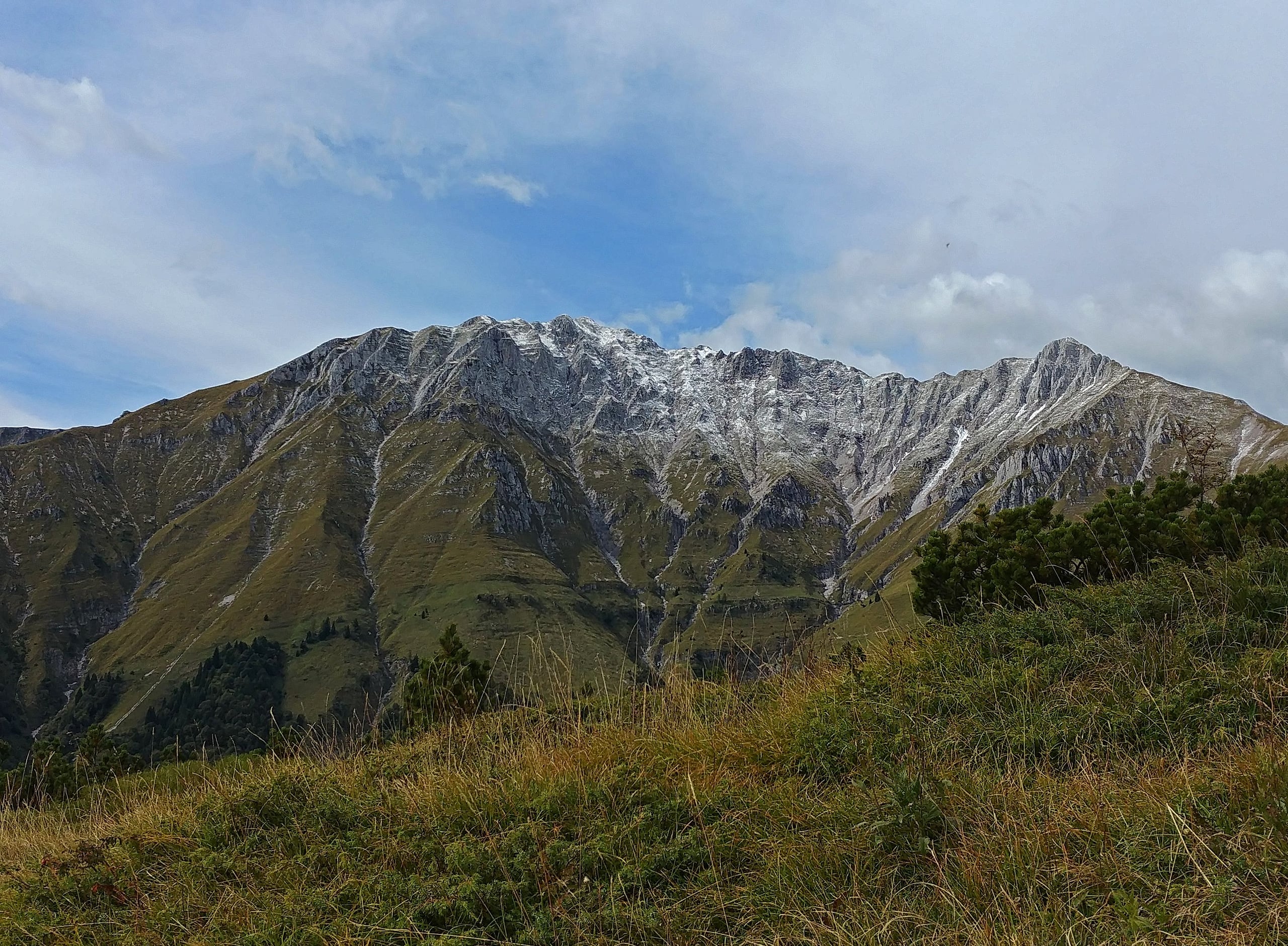
Cima di Menna (2,300 m) from Zorzone
Cima di Menna, 2,300 m, from Zorzone on CAI trail 234: 1,250 m and 4 hours up through Val Carnera and the MAGA bivouac, with no water along the way.
The Cima di Menna, also called Monte Menna, is the mountain that closes the Oltre il Colle basin to the north, above Zorzone: 2,300 metres for Wikipedia and Wikidata, 2,299 in the CAI description. It belongs to a small massif with the Cima di Pizzo and looks over the Brembana valley on one side and the Arera on the other. It is the M of MAGA, the acronym of the four peaks of the basin, Menna, Arera, Grem and Alben, which gives its name to the Zorzone group that runs the bivouac and to the skymarathon.
The classic route from Oltre il Colle is CAI trail 234 from Zorzone, 1,019 metres: it climbs Val Carnera through the woods, passes the Cascina Mattuida, 1,470 metres, and over thin meadows reaches the MAGA bivouac, the Rifugio Palazzi, at 2,005 metres on Passo di Menna; from there a ridge leads to the summit. The CAI gives 4.8 kilometres, about 1,250 metres of ascent, 4 hours up and 2 h 15 down, grade E.
It is a long, dry outing: Gulliver and Luca Gherardi report that there is no water along the route. The CAI's grade E applies to trail 234, but the final ridge has steep, exposed sections, and the CAI itself grades EE the stretch of ridge that comes up from the Roncobello side.
A Second World War story hangs over the mountain: on the night of 4 October 1944 an American B-24 bomber, the Lady Irene, crashed just below the ridge, at a place called Pezzadello, with thirteen people on board. A cross marks the spot and a memorial in Zorzone keeps remains of the aircraft.
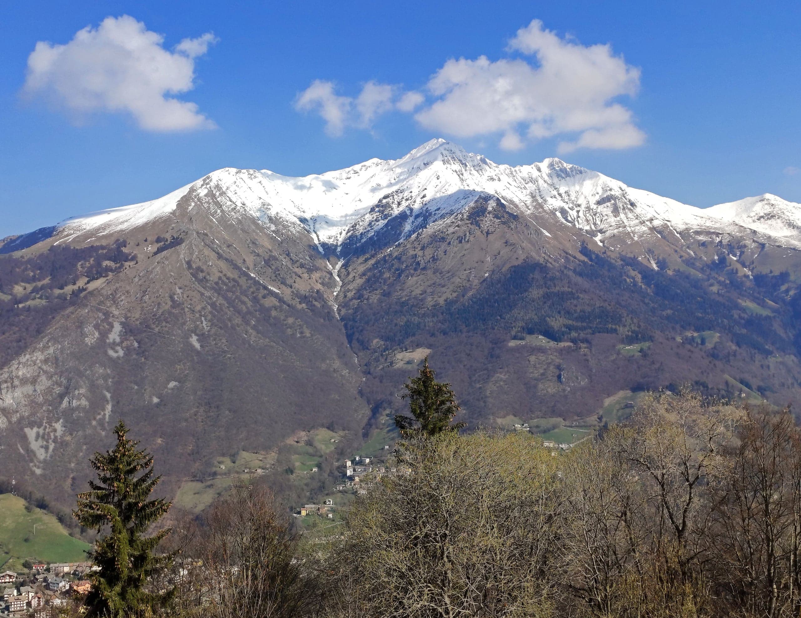
Photo: MatthewGhera · CC BY 3.0
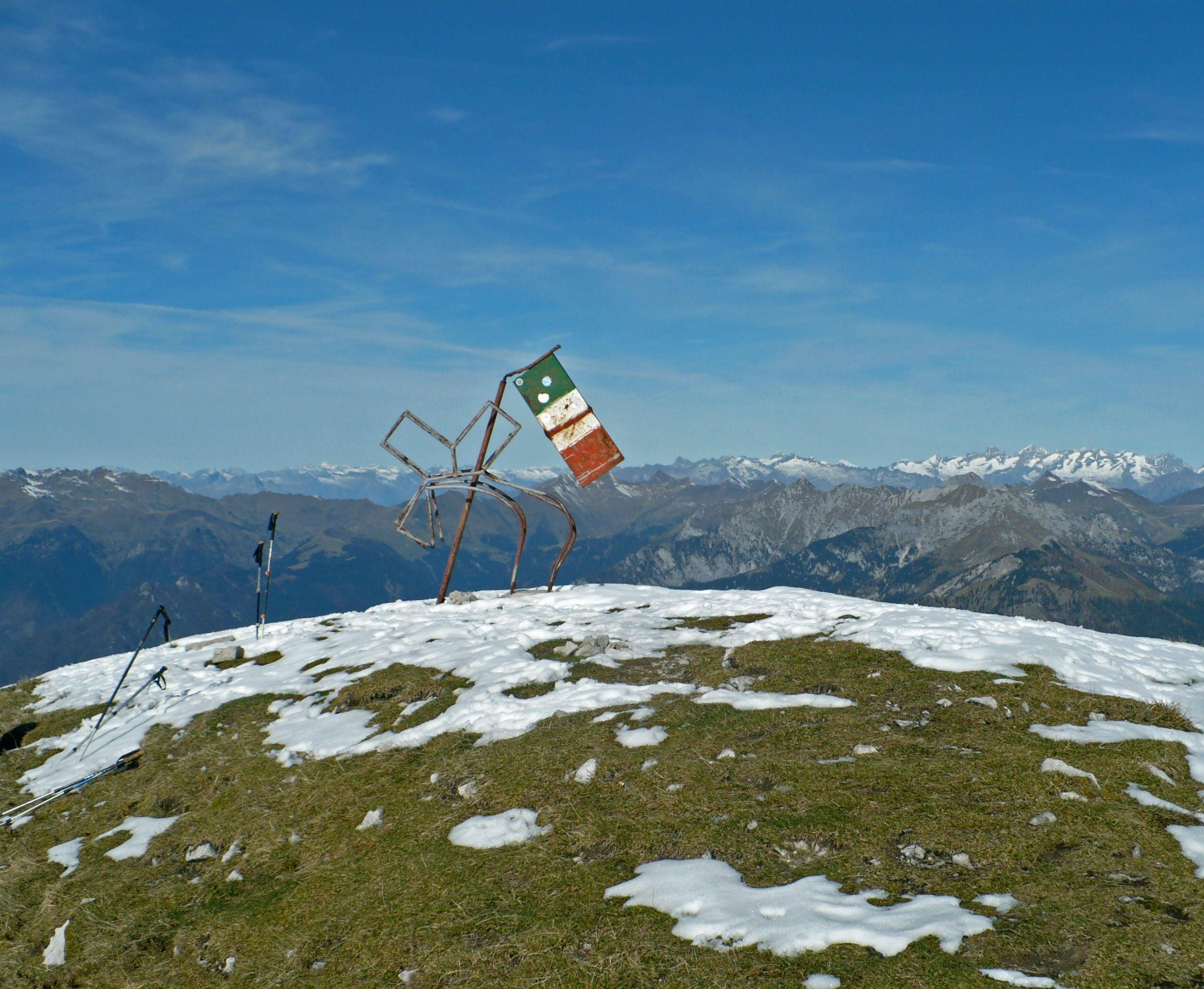
Photo: MatthewGhera · CC BY 3.0
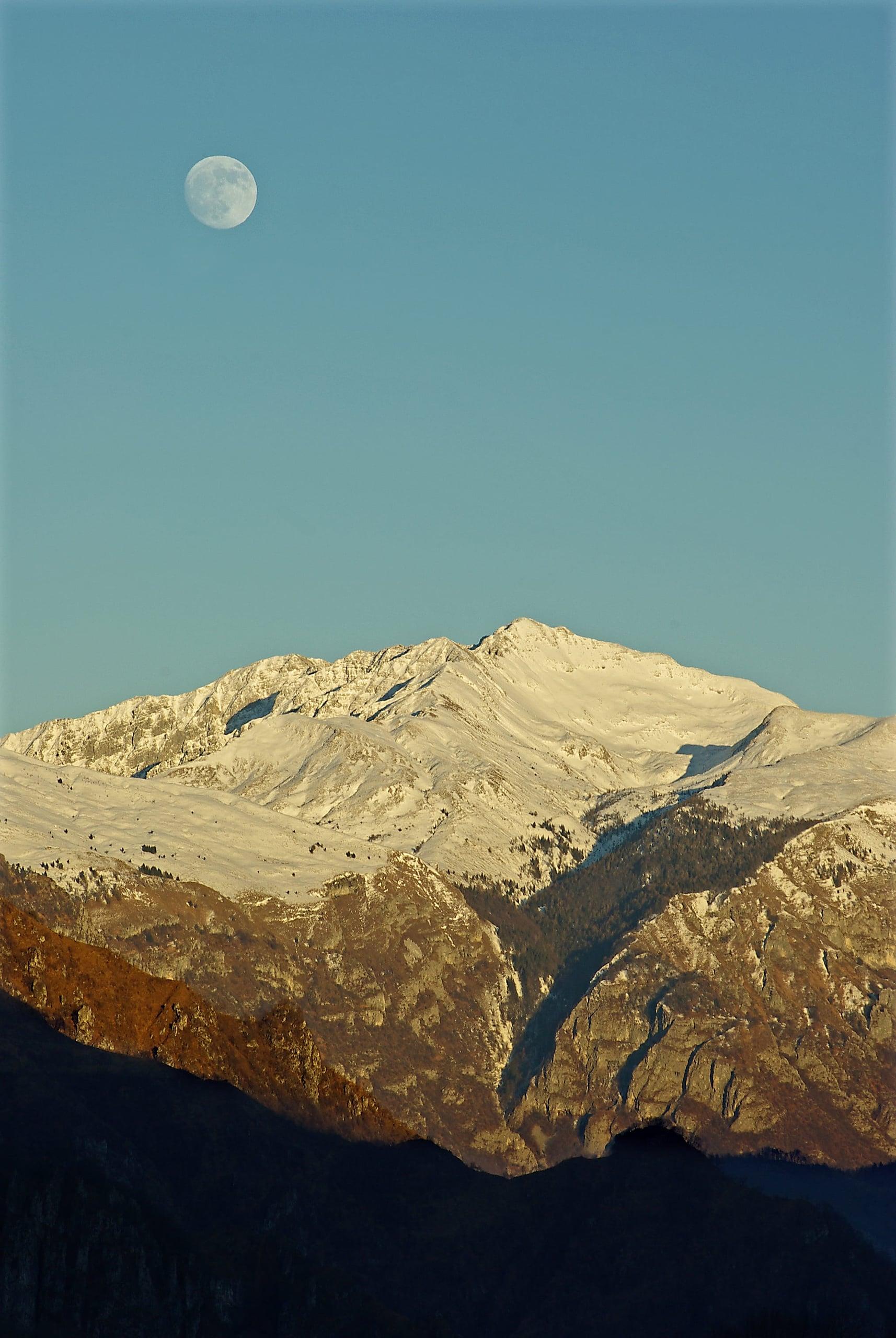
Photo: Italian walrus-63 · CC BY-SA 4.0
The route step by step
From Zorzone you climb north through the woods, on the left bank of Val Carnera, the valley between the slope of Monte Aral and the Chignol d'Aral. Diska describes the start along via Piani Bracca and via Monte Menna, then the path that leaves the road on the left, climbs through the woods and crosses a dirt track. At about 1,200 metres, next to a stony gully, the 234 splits: the direct route climbs to the right of the gully, the panoramic route continues on the track and is a quarter of an hour longer; higher up the two paths rejoin.
The direct route climbs Val Carnera steeply, crosses an open gully, passes to the other side of the valley at about 1,300 metres and reaches the Cascina Mattuida, 1,470 metres, with a large centuries-old beech beside it. A short flight of steps between the two buildings puts you back on the path, faint at first, which climbs north over thin meadows. Higher up the trail runs close to the two cables of a goods ropeway, and a sign warns to watch out for suspended loads. A last steep ramp, with the metal cross near the hut already in view, brings you to Passo di Menna.
From the bivouac, at 2,005 metres, the CAI has you turn right, east, up the spur to 2,150 metres, then north along the ridge to the summit cross; Gulliver speaks of a faint path, Gherardi of very steep and exposed points in the last stretch. From the bivouac to the summit takes about an hour. The descent is by the same route, or from the Cascina Mattuida you can take the panoramic route, which at a junction also lets you pass through the Piani Bracca.
Getting to Zorzone and where to park
Zorzone is the hamlet of Oltre il Colle at about 1,016-1,019 metres. From the main village, at kilometre 37 of the SP27, take the road beside the petrol station that descends to the bridge over the Parina stream, at about 850 metres, and climbs the other side. The CAI recommends parking in via Colombi; Diska describes a large car park at 1,020 metres reached via via Giorgi, Gulliver a small lay-by at the hairpin on via Menna.
From Bergamo you arrive through the Brembana valley, Zogno and Val Serina, or from the Seriana valley via Ponte Nossa and the Colle di Zambla, then dropping down to Oltre il Colle. When the SP27 is closed, as happened from 28 August to 1 October 2026 because of the landslide at Rosolo di Algua, traffic from the Brembana side goes via Costa Serina.
The MAGA bivouac and the Rifugio Palazzi
At Passo di Menna there is one building with two functions. The Rifugio Palazzi, which the CAI calls Bivacco Palazzi Gerolamo, is usually closed and opens at the request of the members of the M.A.G.A. group of Zorzone, which runs it; Gulliver says that booking and keys go through the Gruppo Quattro Cime M.A.G.A. The bivouac, a room on the upper floor, is always open: reports describe a fireplace, a table, benches and a few camp beds for emergencies, from two to five depending on who visited; Diska found no blankets.
The elevations do not agree: the CAI trail pages give 2,005 metres for both the bivouac and Passo del Menna, the bivouac page 2,095, OpenStreetMap 1,995 for the pass. On the first Sunday of August the Sagra del Monte Menna, the mountain festival, is held up there.
The B-24 Lady Irene: the night of 4 October 1944
On 4 October 1944, at 6.45 pm, a B-24 Liberator took off from Brindisi on a secret mission: it carried supplies for the partisans and three Italian agents of the OSS, the American secret service, to be parachuted into the Bergamo area. La Voce delle Valli places the drop zone near Lake Endine; the American report studied by the researcher Giulio Borlini, quoted by L'Italo-Americano, gives the hills of San Fermo near Lake Iseo. With low cloud and strong wind the commander, Charles Robert Sloan, called off the drop.
Shortly afterwards the aircraft crashed below the ridge of the Menna, at about 2,250 metres, at Pezzadello. The ten American airmen, aged between 20 and 29, and the three Italian agents died; only one of the agents has been identified. At dawn the next day the first miners and villagers climbed to the site. The bodies were buried up there and remained until after the war, until early 1950 according to La Voce delle Valli, when the United States moved them to a common grave at Jefferson Barracks National Cemetery in St. Louis. The salvaged metal sheets were turned into pots, lids and buckets in the village.
The causes were never clarified: bad weather, in the simplest hypothesis, or anti-aircraft damage, according to some witnesses who saw the aircraft already in flames. At the crash site stands a wooden cross made by the Trappist monks of New Melleray Abbey in Iowa; since 2016, in a wing of the Museo dei Minerali in Zorzone, a memorial born from the research of Massimo Maurizio displays remains of the aircraft and the utensils made from its sheets.
From Roncobello: CAI trail 235
From the Brembana side you climb from Costa di Roncobello, 1,025 metres, on trail 235: woods, the Corna Buca, a vast cave at 1,292 metres, the clearing of the Baita dello Zoppo or Baita di Baresi, 1,383 metres, then the steep gully called «Il vallone» up to Passo del Menna and the ridge eastwards to the summit. The CAI gives 4.7 kilometres, about 1,300 metres of ascent, 4 hours up and 2 h 15 down, grade EE for the ridge section, season May to October and parking at Costa, in via Ronchetto. With two cars, going up one side and down the other turns the outing into a traverse.
What you can see from the summit
Luca Gherardi describes to the north the upper Brembana valley with the Pizzo dei Tre Signori, the area of the Rifugio Benigni and the Ponteranica lakes, Passo San Marco and in the distance the Valtellina peaks; on the other side stand out the outlines of the Pizzo Arera and the Corna Piana. The regional hut portal, on the Capanna 2000 page, links to a sunrise time-lapse filmed from the Cima di Menna itself.
When to go and how to prepare
The CAI gives the 234 from April to October and the 235 from May to October, with boots and high-mountain clothing; Gulliver gives the route a southern aspect. With no water on the way up, in summer it is worth starting early and carrying plenty. In a thunderstorm the shelter to keep in mind is the always-open bivouac at Passo di Menna.
For a short outing Luca Gherardi suggests going up by the panoramic route and stopping at the Cascina Mattuida, at 1,470 metres, without continuing to the pass.
In detail
Times and elevations on trail 234
| Stage | Elevation | Time from the start | Notes |
|---|---|---|---|
| Zorzone, via Colombi | 1,019 m | — | Car park recommended by the CAI |
| Fork between direct and panoramic routes | about 1,200 m | — | The direct route is a quarter of an hour shorter (Diska) |
| Cascina Mattuida | 1,470 m | — | Large old beech; end of the track of the panoramic route |
| MAGA bivouac – Rifugio Palazzi, Passo di Menna | 2,005 m | 2 h 30 (Gulliver, Diska) | Bivouac room always open |
| Spur | 2,150 m | — | Turn north along the ridge |
| Cima di Menna | 2,300 m | 4 h (CAI); 3 h 30 (Gulliver) | Summit cross; about 1 h from the bivouac |
Elevations from CAI Bergamo; summit at 2,300 m for Wikipedia and Wikidata. Descent: 2 h 15 according to the CAI.
Practical tips
Before you set off
- Set off with all your water: there are no springs along trail 234.
- Do not linger under the ropeway cables: a sign warns to watch out for suspended loads.
- If the weather turns, the bivouac at Passo di Menna is always open: it is the highest shelter on the way up.
- Take the final ridge slowly, especially on the way down: it is the steepest and most exposed part of the outing.
- Poles help on the long descent of Val Carnera, stony in places.
- Back in the village, the Lady Irene memorial in the Museo dei Minerali in Zorzone tells the story of the crash on the mountain you have just climbed.
Grade E. E, Hiker: marked paths or tracks over varied terrain; requires fitness and proper footwear.
FAQ
Frequently asked questions: Cima di Menna (2,300 m) from Zorzone
How demanding is the climb to the Cima di Menna from Zorzone?
The CAI grades trail 234 E, but the figures call for fitness: about 1,250 metres of ascent, 4.8 kilometres, 4 hours up and 2 h 15 down. The final ridge above the bivouac has steep, exposed sections and there is no water along the route.
How long does it take to reach the MAGA bivouac?
About 2 h 30 from Zorzone according to Gulliver and Diska, on the direct route up Val Carnera; the panoramic route takes a quarter of an hour longer. From the bivouac to the summit of the Cima di Menna it then takes about an hour.
Is the MAGA bivouac always open?
The bivouac room, on the upper floor, is always open and has a fireplace, a table, benches and a few camp beds for emergencies, without blankets. The Rifugio Palazzi, in the same building, is usually closed and opens at the request of the members of the M.A.G.A. group of Zorzone.
Where do you park in Zorzone for the Cima di Menna?
The CAI recommends via Colombi in Zorzone. Other reports mention a large car park at 1,020 metres reached via via Giorgi and a small lay-by at the hairpin on via Menna. Zorzone is reached from the main village by the road beside the petrol station on the SP27.
Is there water along the path to the Cima di Menna?
No. Gulliver and Luca Gherardi report that there are no springs along the route: you must leave Zorzone with water for the whole day; the CAI allows 4 hours up and 2 h 15 down.
What happened to the B-24 that crashed on Monte Menna?
On the night of 4 October 1944 the B-24 Liberator Lady Irene, which had taken off from Brindisi on a supply mission for the partisans, crashed just below the ridge, at about 2,250 metres at Pezzadello: ten American airmen and three Italian OSS agents died. A wooden cross marks the spot and since 2016 a memorial in Zorzone has kept its remains.
Can you climb the Cima di Menna from Roncobello?
Yes, on CAI trail 235 from Costa di Roncobello via the Corna Buca, the Baita dello Zoppo and the Vallone gully to Passo del Menna: 4.7 kilometres, about 1,300 metres of ascent, 4 hours up, grade EE for the ridge section.
What does MAGA mean?
It is the acronym of the four peaks around the Oltre il Colle basin: Menna, Arera, Grem and Alben. The Zorzone group that runs the bivouac at Passo di Menna bears the name, and so does the Maga Skymarathon, the mountain race that touches all four summits.
Sources
- CAI Bergamo, geoportale – sentiero 234 Zorzone / Bivacco MAGA / Monte Menna · www.caibergamo.it · accessed on 1 October 2026
- CAI Bergamo, geoportale – sentiero 235 Costa (Roncobello) / Cima di Menna · www.caibergamo.it · accessed on 1 October 2026
- CAI Bergamo, geoportale – Bivacco MAGA (Bivacco Palazzi Gerolamo) · www.caibergamo.it · accessed on 1 October 2026
- Wikipedia – Cima di Menna · it.wikipedia.org · accessed on 1 October 2026
- Wikidata – Cima di Menna · www.wikidata.org · accessed on 1 October 2026
- OpenStreetMap – vetta della Cima di Menna (nodo 492484259) · www.openstreetmap.org · accessed on 1 October 2026
- Gulliver – Menna (Cima di) da Zorzone per il sentiero n°234 (autore ghizlo, revisione 16/04/2025) · www.gulliver.it · accessed on 1 October 2026
- Luca Gherardi – Cima di Menna da Zorzone · lucagherardi.com · accessed on 1 October 2026
- Diska – Rifugio Palazzi e bivacco M.A.G.A.: relazione dei due percorsi da Zorzone · www.diska.it · accessed on 1 October 2026
- La Voce delle Valli – La tragica vicenda dell'aereo Lady Irene e il suo schianto sul monte Menna (Eleonora Busi, 10/09/2020) · www.lavocedellevalli.it · accessed on 1 October 2026
- L'Italo-Americano – Oltre Il Colle, where peak holds heroic tale of Americans, Italians and WWII · italoamericano.org · accessed on 1 October 2026
- Pro Loco di Oltre il Colle – Esperienze (memoriale del B24 Lady Irene) · www.oltreilcolleturismo.it · accessed on 1 October 2026
- Maga Skymarathon – Menna, Arera, Grem e Alben · www.magaskymarathon.it · accessed on 1 October 2026
- Valbrembanaweb – Val Serina, dopo un mese riaperta la provinciale (01/10/2026) · valbrembanaweb.com · accessed on 1 October 2026
- OpenStreetMap – parcheggio di via Colombi a Zorzone (nodo 2820183971): coordinate · www.openstreetmap.org · accessed on 1 October 2026
Page verified on
Nearby
More pages from around here
Hikes · 2 minutes
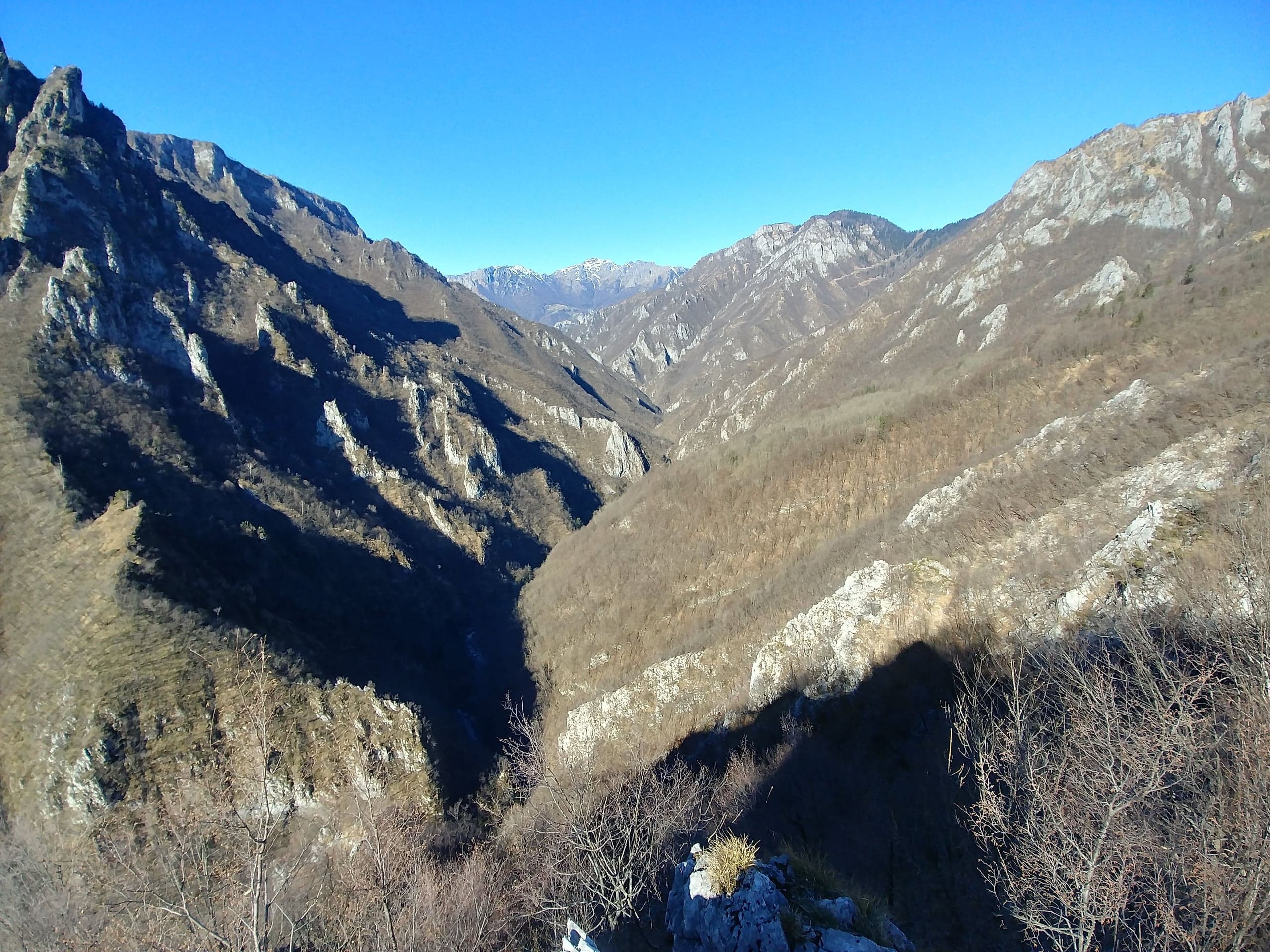
Val Parina: the traverse from Zorzone to Scalvino on CAI trail 259
Val Parina, Zorzone to Scalvino on CAI trail 259: 12 km and 450 m of descent through gorges, chained ledges and the rails of an old timber and marble line.
Museums · 2 minutes
Museum of Minerals and Mining in Zorzone
Three floors on the zinc and lead mines of Oltre il Colle in Zorzone's old school: miners' tools, a rebuilt tunnel, local minerals and a 1944 memorial.
Churches · 1 minute
Church of the Santissima Trinità in Zorzone
Zorzone's parish church, a parish since 1636, rebuilt between 1745 and 1755 to a design by Giovan Battista Caniana: dome, stucco work and a canvas of 1628.
Villages · 2 minutes
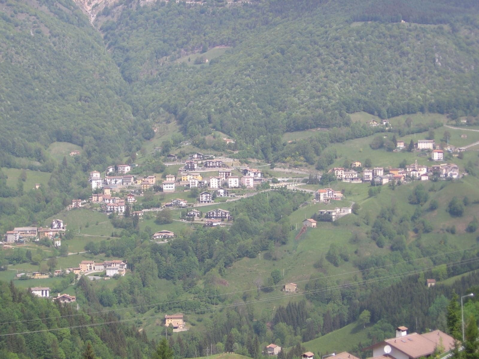
Zorzone, the mining village
Zorzone, at 1,019 metres, is the hamlet of the Val Vedra zinc mines: Caniana's church, the mining museum, 23 frescoes on the houses and the trails to the Menna.