Skip to content
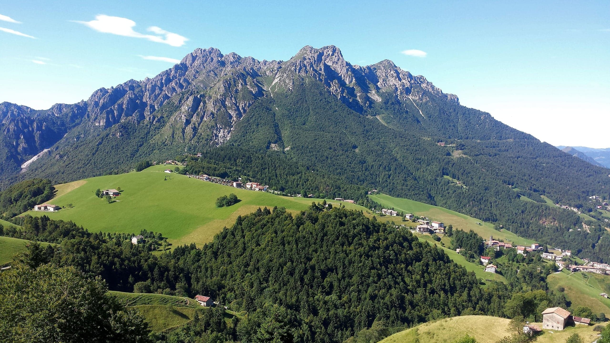
Zambla Bassa, a hamlet of Oltre il Colle, with the bell tower and houses on green meadows at the foot of rocky peaks

Hamlet of Oltre il Colle · Val Serina

Zambla Bassa

Zambla Bassa, hamlet of Oltre il Colle at 1,060 m: the parish church of Santa Maria Maddalena, Venetian-era hamlets, old mule tracks and how to get there.

Elevation1,060 m a.s.l.
Inhabitants (2021)86
MunicipalityOltre il Colle (BG)
Postcode24013

Zambla Bassa is the smallest and quietest of the localities of Oltre il Colle: 86 residents at the 2021 census, at 1,060 metres according to ISTAT and 1,050 according to the Pro Loco. It sits halfway up the slope between the main village and Zambla Alta, but not on the provincial road: via Vidali, the church road, branches off the SP27 and in a few hundred metres takes you among the houses. Those driving towards the Colle di Zambla see it from above and carry on; those who stop find one of the richest churches in the basin and a fabric of farming hamlets that can still be read.

The settlement is not a compact village but a string of hamlets that grew up far from one another, as befits a community that lived on livestock: Cà di Merèi, Cà di Vidài, Cà Pezzà, Cà Falgher, Vallomi, Gremsolì, Cà di Ress, and higher up Bertogli, Zucchi, Armellini and Moratti, already formed by around 1500 according to the research of Massimo Maurizio. Several names survive in today's streets, via Vidali, via Falghero and via Gremsolino. In the houses you can still recognise the style of the Venetian period: very thick walls, small splayed windows, arched doorways in hand-worked stone and buttress-like retaining walls.

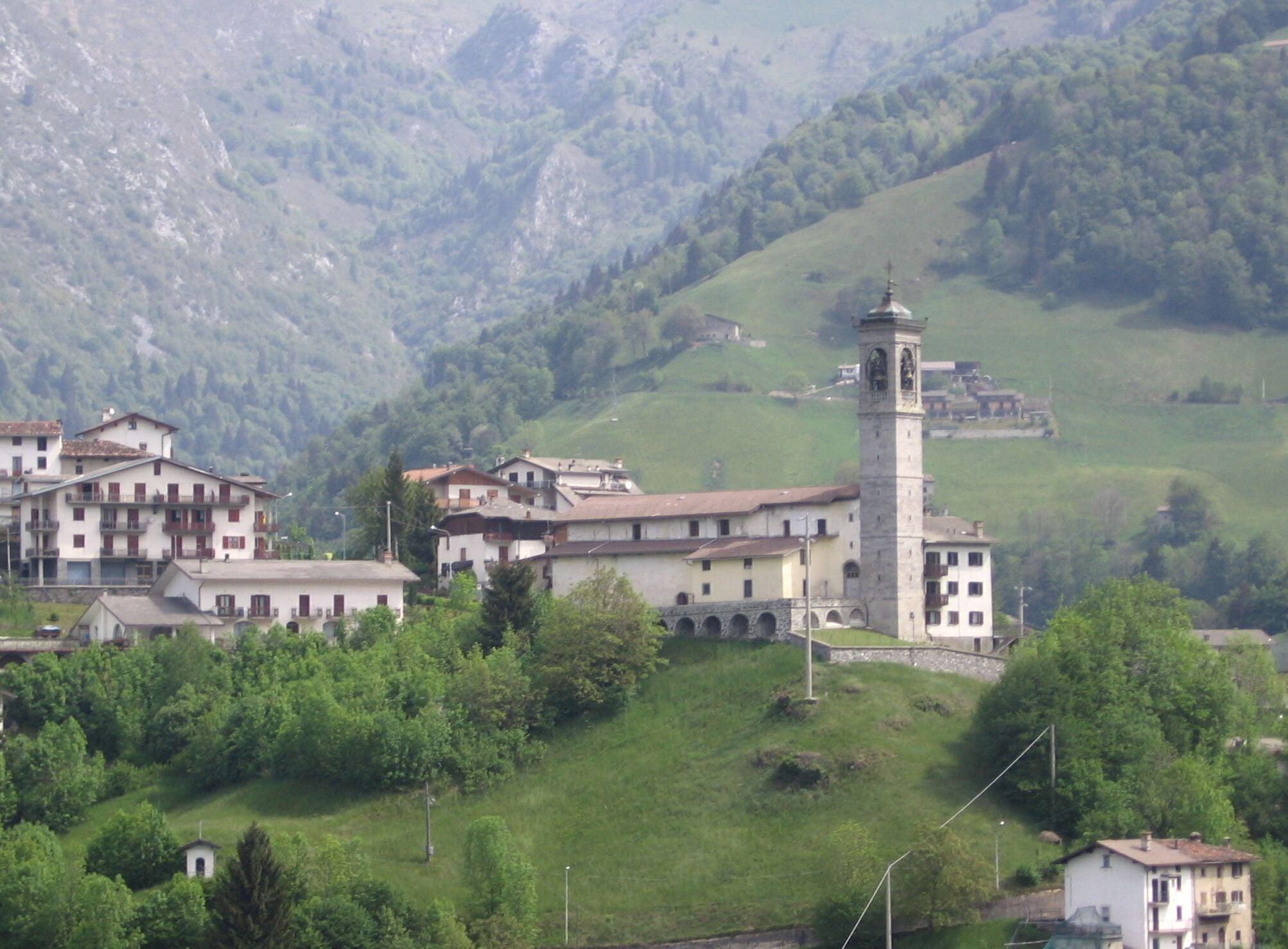
The high point of the village, in every sense, is the parish church of Santa Maria Maddalena: it stands on top of a knoll where four roads meet, and its slender bell tower can be seen from every corner of the basin. Inside there is more than a village of this size would lead you to expect: a single nave with a low barrel vault in seven bays, six altars in deep chapels, an organ installed in 1799 by the firm of Giuseppe Serassi and above all the paintings by Gian Paolo Cavagna, including a Santa Maria Maddalena in Glory.

Not far away, at the crossroads of four old mule tracks, stands the small church of Santa Maria Addolorata: one of the oldest places of worship in the basin, privately owned for centuries and bequeathed to the parish only in the 1990s, but never closed to worship, as the small ex-voto paintings on its walls show. This was the route of the winter mule track towards Oltre il Colle and Val Serina, the one past the mill known as Ol mulì di Balsì, now in ruins.

Zambla Bassa is not an equipped base: the Pro Loco lists a single business there, a grocery. To eat, rent equipment or sleep you go up to Zambla Alta, and for the pharmacy, petrol and municipal offices you go down to the main village. Nor is it a starting point for the high mountains: the trails to Monte Alben start from the Colle di Zambla, a little over three kilometres further up, and those to Pizzo Arera and Capanna 2000 from Plassa and Alpe Arera. On the other hand it is the right place for anyone looking for silence, meadows and old stone a few minutes from everything.

Zambla Bassa, a hamlet of Oltre il Colle, covered in snow with the church and white meadows seen from the summit of the Grem
Zambla Bassa under snow, from the summit of the Grem
Photo: Ago76 · CC BY-SA 3.0

Elevation and location

ISTAT gives the centre of Zambla Bassa 1,060 metres, the Pro Loco 1,050; the elevation model used by Open-Meteo gives about 1,045 metres in front of the church and about 1,065 on the provincial road, at the junction. Zambla Bassa is therefore just higher than the main village, which stands at 1,030 metres, and about 140 metres below Zambla Alta.

The village lies beside the SP27: from the provincial road, at the junction with the «Zambla Alta (bivio Zambla Bassa)» stop, via Vidali branches off, descending towards the church and running through the settlement. From piazza Tiraboschi, in the main village, to the church it is about 3.8 kilometres; from Zambla Bassa to Zambla Alta about 2.3 kilometres, and the Colle di Zambla is about a kilometre further on.

Hamlets and outlying settlements

The research of Massimo Maurizio, published in 2014 by the Blog della Valserina, lists the hamlets of Zambla already formed by around 1500: Cà di Merèi, Cà di Vidài, Cà Pezzà, Cà Falgher, Vallomi, Gremsolì and Cà di Ress, and higher up Bertogli, Zucchi, Armellini and Moratti. They grew up far from one another, and from the very beginning the population devoted itself to raising livestock.

Today's street names keep several of them: via Vidali, via Falghero and via Falgherino, via Gremsolino, as well as via Sottochiesa and via Sasso della Volpe. On the provincial road, between the main village and the Zambla Bassa junction, lies Mincucco: at the 2011 census ISTAT treated it as a cluster of its own, at 1,040 metres, with 22 residents, whereas in 2021 it no longer appears among the separate localities.

Architecture and stone houses

The character of Zambla Bassa lies in the houses built under Venetian rule, which Pendughet's research describes like this: very wide walls, few small splayed windows, an almost military look; the round-arched entrance with the family's symbols carved in the keystone, a spacious entrance hall and a great deal of worked wood. Renovations in the second half of the twentieth century often used unsuitable materials, which covered or replaced the original ones.

The traces show above all at the base of the buildings, in retaining walls that are wide at the bottom and narrow as they rise, like buttresses, easy to spot in the Cà di Vidài hamlet; and in the arched doorways of hand-worked stone, the finest of which, in the Vallomi hamlet, is topped by a small balcony on a stone base. At Cà di Ress a cluster of stables, hay barns and farmers' houses survives.

The census figures confirm the impression: in 2011 one residential building in three in Zambla Bassa, 31 out of 97, had been built before 1919, and none had been built after 2000. These are the residential buildings by period of construction according to the 2011 ISTAT census:

  • Before 1919: 31 buildings
  • From 1919 to 1960: 14
  • From 1961 to 1980: 36
  • From 1981 to 2000: 16
  • After 2000: none

The old mule tracks and fountains

Before the road for vehicles, the basin was crossed by mule tracks, and Zambla Bassa was one of their junctions. According to Pendughet the mule track that climbed from Oneta and crossed the Colle di Zambla split in two: the summer one kept its height towards the Mussa and then Valpiana, Dossena and the Brembana valley; the winter one dropped straight down to Zambla Bassa, passed in front of the small church of the Addolorata, descended to the mill known as Ol mulì di Balsì and continued towards the Pendughet, Oltre il Colle, the Col d'Anì, Valpiana and Dossena.

Along these routes small structures remain that are worth a careful look: the old fountain on the mule track that runs down from the small church to Cà di Ress, whose basin stones are held together by iron clamps sealed with lead, and the base of another fountain at Cà di Vidài. The Balsì mill, on the other hand, has been lost to landslides and neglect. The present state of the tracks is not documented by recent sources: ask in the village before walking them.

How many people live here: population over time

The municipality publishes only the total number of residents; for the hamlets the figures come from the censuses, which ISTAT processes by inhabited locality. In 2011 Zambla Bassa had 123 residents in 60 households, in 2021 86 residents in 52 households: a fall of almost a third in ten years, steeper than that of the municipality as a whole, which over the same period went from 1,058 to 980 inhabitants. Locality boundaries shift a little from one census to the next, so the comparison is indicative.

As in the other hamlets, houses far outnumber households: in 2011 ISTAT counted 60 dwellings occupied by residents and 297 empty or used only by non-residents, in 2021 341 dwellings in all and 87 buildings.

  • 2011 census: 123 residents in 60 households; 357 dwellings, 60 of them occupied by residents
  • 2021 census: 86 residents in 52 households; 341 dwellings and 87 buildings

What's in the village: shops and services

There is a single shop in the hamlet, the grocery Da Sofia – Alimentari Tiraboschi, which the Pro Loco lists with the number 0345 95248. Everything else is a few minutes away: in Zambla Alta, 2.3 kilometres further up, restaurants, bars, equipment rental and almost all the places to stay; in the main village, 3.8 kilometres away, the basin's only pharmacy, the bank, the post office, the petrol station and the municipal offices. The pages with addresses, phone numbers and opening hours are under Food and services.

Where to park and where the bus stops

No public car parks are mapped in the settlement on OpenStreetMap, and via Vidali is a narrow municipal road serving the houses: for a short visit leave the car where it does not block anyone, for a whole day it is better to use the car parks of the main village or those of Zambla Alta and the Colle di Zambla.

Arriva's line B timetable gives no times for Zambla Bassa: the nearest stops with a timetable are Oltre il Colle piazza Tiraboschi and Zambla Alta Albergo Miramonti. On the provincial road, at the turn-off for the village, OpenStreetMap does however map a stop called «Zambla Alta (bivio Zambla Bassa)», about four hundred metres from the church, on the route of the same services. Buses run only Monday to Saturday, with a compulsory change at Zogno for those coming from Bergamo.

Where the name comes from

Zambla Bassa is the historic Zambla: when sources mention the parish of Zambla, founded in 1587, they mean this one, and Pendughet's research specifies that the division into the two present hamlets dates from the 1930s. As early as the sixteenth century, according to Lombardia Beni Culturali, Zambla Alta and Zambla Bassa were two of the municipality's five colonnelli.

The oldest name given by the same research is Zolambra, used in the deed of 4 May 1287 by which the inhabitants of Serina and Grimoldo bought the upper Val Serina, when the area was still dense forest. The sources consulted do not offer a documented etymology, so none is given here. The inhabitants are zamblesi.

How cold it gets: the climate month by month

No official climate averages are published for Zambla Bassa. The figures below were worked out by this guide from the 1991-2020 daily data of Copernicus's ERA5 reanalysis, downloaded from the Open-Meteo historical archive: temperatures from ERA5-Land (0.1° grid, about 10 kilometres) adjusted to the point's elevation of about 1,065 metres, precipitation and snow from the 0.25° ERA5 grid, about 25 kilometres, the same for the whole basin. Snow means fresh snowfall, estimated by the model.

The picture: long winters, with about 140 frost nights a year and average lows below zero from November to March; cool summers, with average highs of 21 degrees in July and August; about 2,000 millimetres of precipitation a year, heaviest between May and August; about two metres of fresh snow in an average season. These are reanalysis estimates, not measurements: a finer reanalysis, CERRA (5.5 kilometres), gives the basin slightly less cold winters and more precipitation.

Monthly averages 1991-2020 (ERA5 reanalysis)

MonthLowHighPrecipitationFresh snow
January−8 °C2 °C70 mmabout 40 cm
February−7 °C3 °C70 mmabout 40 cm
March−3 °C7 °C100 mmabout 35 cm
April1 °C11 °C170 mmabout 25 cm
May5 °C15 °C210 mmrare (about 5 cm)
June9 °C19 °C230 mm—
July12 °C21 °C230 mm—
August12 °C21 °C240 mm—
September8 °C17 °C190 mm—
October5 °C13 °C200 mmrare (about 5 cm)
November0 °C7 °C180 mmabout 25 cm
December−6 °C3 °C90 mmabout 40 cm

Estimates from the Copernicus ERA5 reanalysis worked out by this guide from Open-Meteo data: not measurements from a weather station. Snow is the fresh snowfall in the month, not the depth on the ground.

When to go

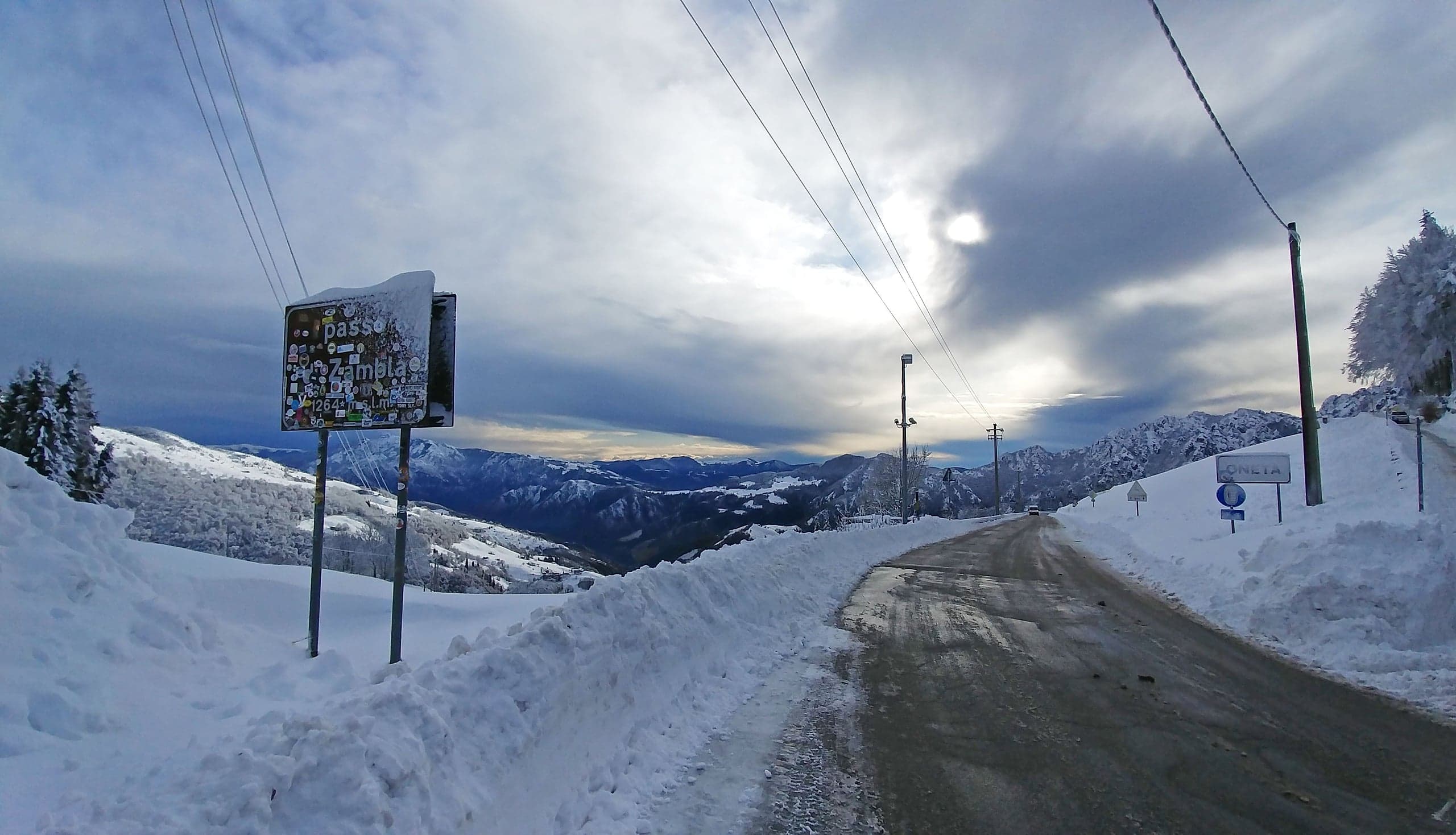
Zambla Bassa can be visited all year, but for exploring the hamlets and mule tracks the easiest period runs from late spring to autumn, without snow. In winter, under snow, the village is beautiful and silent, but the streets are narrow and steep: on provincial roads from 15 November to 15 April winter tyres or chains on board are required by ordinance of the Province of Bergamo.

Church opening hours are not published: to see the interiors, ask at the parish of Santa Maria Maddalena and Santa Maria Immacolata. The basin's festivals and events are on the Events page.

Not to be missed

What to see in Zambla Bassa

  1. Parish church of Santa Maria Maddalena

    Built on a knoll where four roads meet, with a bell tower visible from the whole basin. The present building is the eighteenth-century rebuilding, reconsecrated on 18 July 1737 by the bishop of Bergamo Antonio Redetti; the bell tower was completed in 1835 and the church enlarged in 1924. Single-nave interior in seven bays with six altars in deep chapels, a presbytery with a dome and the four evangelists frescoed in the pendentives, and a high altar in green marble with onyx details.

  2. The paintings by Gian Paolo Cavagna

    The parish church holds works by the Bergamo painter Gian Paolo Cavagna: a Santa Maria Maddalena in Glory and two panels with the Madonna and Child Jesus, St Charles and St Francis. Cavagna, born in Bergamo in 1550 and died in the city in 1627, is one of the leading names of Bergamo painting between the sixteenth and seventeenth centuries: his presence here measures how much Zambla mattered when the church was furnished.

  3. The Serassi organ of 1799

    The instrument was installed in 1799 by the firm of Giuseppe Serassi, the dynasty of master organ builders active for six generations between 1720 and 1895 and found throughout Lombardy. It is one of the signs of how wealthy the community of Zambla was compared with the rest of the basin, at the time when it lived on cattle and cheese.

  4. Small church of Santa Maria Addolorata

    A small place of worship at the crossroads of four old mule tracks, among the oldest in the basin. Privately owned until the 1990s but never closed to worship, it preserves a wooden choir in the gallery above the entrance and numerous ex-voto paintings; its square bell tower recalls those of small convents. On the north wall remains a stone plaque with an inscription now illegible.

  5. The Venetian-era hamlets

    Cà di Merèi, Cà di Vidài, Cà Pezzà, Cà Falgher, Vallomi, Gremsolì and Cà di Ress were already formed by around 1500. In several you can still read thick walls, splayed windows, arched doorways in hand-worked stone and buttressed retaining walls. At Cà di Ress the cluster of stables, hay barns and houses tells the story of the livestock economy.

  6. The fountains and the mule track to Oltre il Colle

    From the small church a mule track descends towards Cà di Ress past an old stone fountain, whose basins are held together by iron clamps sealed with lead; another fountain, of which the base remains, stands at Cà di Vidài. The same network of mule tracks was the winter road to Oltre il Colle and Val Serina.

History

The history of Zambla Bassa

On 4 May 1287 the inhabitants of Serina and Grimoldo bought the upper Val Serina for 624 imperial lire. Zambla, then Zolambra, was still a dense forest: it was cleared over the following centuries, the last area of the basin to be settled, and turned into pasture, and from there its fortune was born. The herds of Zambla, the bergamine, were the most numerous and profitable in the basin, and its cheeses the most sought after in the valley. The first parish in the area, dedicated to St Bartholomew, had been founded by decree of the bishop of Bergamo Polidoro Foscari on 5 April 1449.

By around 1500 Zambla was a compact community, spread across the hamlets still recognisable today. In 1587 the heads of families presented to bishop Girolamo Ragazzoni, on a pastoral visit to Oltre il Colle, a request to separate from the church of San Bartolomeo and form an independent parish, offering an endowment and a contribution to support their own priest; the separation was decreed on 17 November 1587. The boundaries were set from Val Grassa to Val Parina, Zorzone remained under San Bartolomeo, and the community kept the right of patronage over the church until 1936.

The present building is the eighteenth-century rebuilding: it was reconsecrated on 18 July 1737 by bishop Antonio Redetti, who confirmed the dedication to the Magdalene, adding that of the Blessed Virgin Mary. In 1778, at the visit of bishop Giovanni Paolo Dolfin, the church had four altars; in 1799 the Serassi organ arrived, in 1835 the bell tower was completed, in 1921 and 1922 new altars were consecrated and in 1924 the building was enlarged. On 27 May 1979 the parish joined the vicariate of Selvino-Serina. A fire in the parish archive of Oltre il Colle destroyed documents that could have clarified the history of the small church of the Addolorata.

Not all of the history is one of prosperity. In spring 1797 Russian and Austrian troops heading for the upper Brembana valley and Valtellina crossed the Colle di Zambla, demanding provisions and animals; on 2 May 1798, when these were not handed over, they set fire to stables and houses and killed civilians. Much later, in the 1930s, Zambla split into the two present hamlets; in 1960 Zambla Alta obtained its own parish and only in 1986 were the two communities reunited in the single parish of Santa Maria Maddalena and Santa Maria Immacolata, based in via Vidali.

Roads and transport

How to get to Zambla Bassa

From Bergamo you drive up the Brembana valley on the SS470 to Ambria di Zogno, take the SP27 of Val Serina and continue through Algua, Serina and Valpiana to Oltre il Colle; from the main village you carry on along the provincial road via Foppa and via Mincucco to the Zambla Bassa junction, where you leave the SP27 for via Vidali, the church road. In all it is about 42 kilometres from Bergamo station, around fifty minutes without traffic according to the calculation on the OpenStreetMap road network; from the main village to the church about 3.8 kilometres. From the Seriana valley you climb from Ponte Nossa along the SP46 of Val del Riso, 14.1 kilometres to the Colle di Zambla (1,264 m), then descend past Zambla Alta to the junction. By bus, Arriva's line B, with a change at Zogno and only Monday to Saturday, has no timetabled stop in Zambla Bassa: the nearest on the provincial road is the one at the junction, about four hundred metres from the church.

FAQ

Frequently asked questions about Zambla Bassa

How high is Zambla Bassa?

ISTAT puts the centre of Zambla Bassa at 1,060 metres above sea level, the Pro Loco at 1,050: so it is just above the main village, which stands at 1,030 metres, and about 140 metres below Zambla Alta. At the top of the same road the Colle di Zambla reaches 1,264 metres.

Are Zambla Alta and Zambla Bassa the same village?

No, they are two distinct hamlets of Oltre il Colle, separated by about 2.3 kilometres of road and, according to the ISTAT elevations, about 140 metres of height difference. For centuries, though, they were a single community, Zambla, with a single parish, and the division into two hamlets dates from the 1930s; today they share again the parish of Santa Maria Maddalena and Santa Maria Immacolata, reunited in 1986.

How many people live in Zambla Bassa?

At the 2021 ISTAT census Zambla Bassa had 86 residents in 52 households, against 123 in 2011. The census counted 341 dwellings in 2021, mostly holiday homes or in any case without residents.

What is there to see in Zambla Bassa?

The parish church of Santa Maria Maddalena, with the paintings by Gian Paolo Cavagna and the Serassi organ of 1799, and the small church of Santa Maria Addolorata with its ex-votos. Outside the churches it is worth touring the hamlets, Cà di Vidài, Vallomi, Cà di Ress, where worked-stone doorways, fountains and buttressed walls from the Venetian era survive.

Are there shops and restaurants in Zambla Bassa?

Just one business: the grocery Da Sofia – Alimentari Tiraboschi. Bars, restaurants, hotels and equipment rental are in Zambla Alta, about 2.3 kilometres further up, while the pharmacy, petrol station, bank, post office and municipal offices are in the main village of Oltre il Colle, about 3.8 kilometres away.

How do you get to Zambla Bassa by car?

You drive up Val Serina on the SP27 to Oltre il Colle and carry on towards the Colle di Zambla; at the Zambla Bassa junction you leave the provincial road and take via Vidali, which leads to the church and the hamlets. From Bergamo station it is about 42 kilometres, from the main village about 3.8. Those coming from the Seriana valley cross the Colle di Zambla and descend past Zambla Alta to the junction.

Is there a bus stop in Zambla Bassa?

Not a timetabled one: Arriva's line B timetable lists Oltre il Colle piazza Tiraboschi and Zambla Alta Albergo Miramonti. On the provincial road, at the turn-off for the village and about four hundred metres from the church, OpenStreetMap maps a stop called «Zambla Alta (bivio Zambla Bassa)» on the route of the same services. Buses run Monday to Saturday, with a change at Zogno.

Where do you park in Zambla Bassa?

No public car parks are mapped in the settlement on OpenStreetMap and the streets are narrow. For a whole day it is better to leave the car in the car parks of the main village, at the Piazzale degli Alpini or near via Capriana, or in Zambla Alta and at the Colle di Zambla.

Why does Zambla Bassa have such a large church for so few inhabitants?

Because between the sixteenth and eighteenth centuries Zambla was the richest community in the basin: it lived on livestock and cheese, and in 1587 it obtained separation from the parish of San Bartolomeo by paying an endowment and the upkeep of its own priest. The church you see today, reconsecrated in 1737, with six altars, the Serassi organ and the Cavagna paintings, is the result of that season.

What is the small church of the Addolorata?

It is the small church of Santa Maria Addolorata, at the crossroads of four old mule tracks, considered one of the oldest places of worship in the basin. It remained privately owned until the 1990s, when its last owner left it to the parish, but it was never closed to worship: the ex-voto paintings on its walls say so. Inside there is a wooden choir in the gallery above the entrance.

Can you reach the Arera and Alben trails from Zambla Bassa?

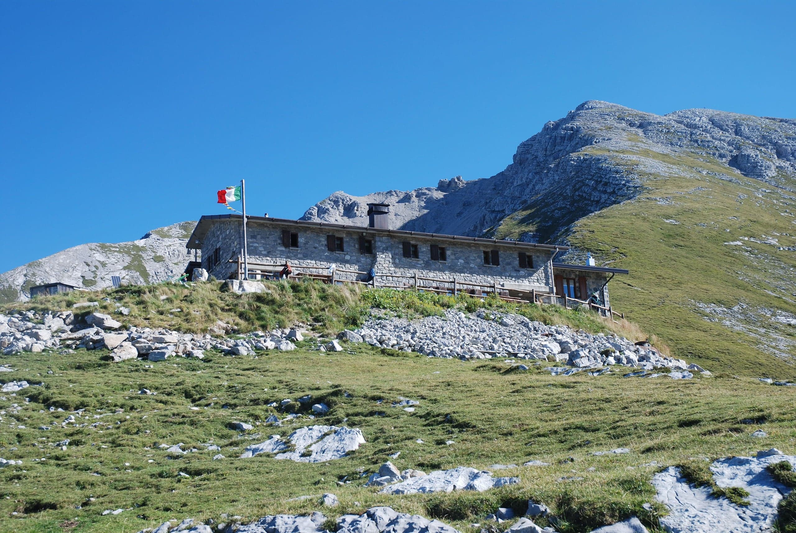
Yes, but you need to move by car. Monte Alben is climbed from the Colle di Zambla, a little over three kilometres further up; Pizzo Arera and the Capanna 2000 hut from Plassa and the Alpe Arera car park, both reached by driving through Zambla Alta. In winter the basin's cross-country tracks are joined at the Passo di Zambla or at Pian della Palla.

What is the climate like in Zambla Bassa?

According to the 1991-2020 averages worked out from ERA5 reanalysis data, the average January low is about −8 °C and the high about 2 °C, with about 140 frost nights a year; in July and August average highs reach 21 degrees. Precipitation is abundant, about 2,000 millimetres a year, and estimated fresh snowfall is about two metres in an average season. These are model estimates, not station measurements.

Sources

Page verified on

Food and services

Shops, bars and restaurants in Zambla Bassa

All services in the municipality

GroceryZambla Bassa, Oltre il Colle

Da Sofia – Alimentari Tiraboschi

Via Vidali 403, Zambla Bassa

Da Sofia, the grocery of Zambla Bassa at via Vidali 403: the hamlet's only shop, phone number, how to get there by car or bus and the nearest other shops.

Open the page →

Verified on 1 October 2026 · source

EmergencyZambla Bassa, Oltre il Colle

Defibrillatore (DAE) del centro parrocchiale di Zambla Bassa

Via Vidali, Zambla Bassa

Opening hours

  • Available 24 hours a day, according to the AREU register

On the outside wall of the parish centre, registered by AREU as a public-access defibrillator. In case of cardiac arrest call 112 at once: the operator guides you and points you to the nearest defibrillator.

Verified on 1 October 2026 · source