Hike · Zorzone · Oltre il Colle
Val Parina: the traverse from Zorzone to Scalvino on CAI trail 259
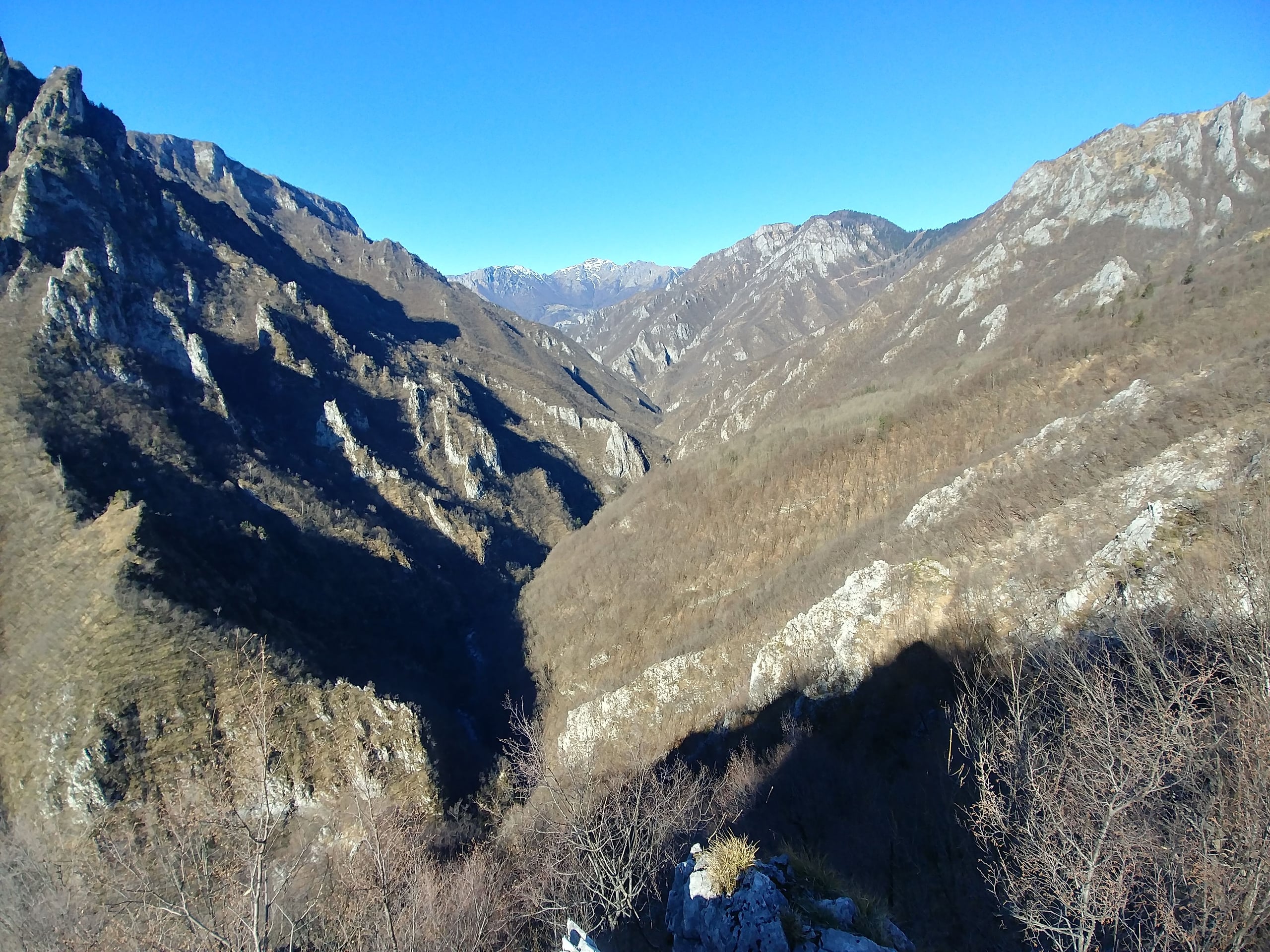
Val Parina, Zorzone to Scalvino on CAI trail 259: 12 km and 450 m of descent through gorges, chained ledges and the rails of an old timber and marble line.
The Val Parina runs for about 15 kilometres from the Orobie down to the Brembo, south of the Cima di Menna; its upper part lies in the municipality of Oltre il Colle, while the lower and middle valley are uninhabited and can only be crossed on foot (Wikipedia). CAI trail 259 starts just before Zorzone and ends at Scalvino di Lenna: about 12 kilometres, 450 metres of descent, a high point of around 990 metres, 4 hours 30 minutes out and 5 hours back according to CAI Bergamo. The CAI Valserina subsection, which walked it as a group in April 2024, reckons 5 hours excluding stops.
The grade is E, but it is no stroll: after the Cappelletta di Petta and an hour of ups and downs in the woods to the meadows of Prà Parina, the path cuts across an overhanging slope with exposed sections protected by chains, then drops to the valley floor and follows the bed of an old narrow-gauge railway to the confluence with the Brembo.
The valley is a Special Area of Conservation of the Orobie Bergamasche Park, chosen for its gorge habitats and for its low human impact: no roads, no inhabited houses, no hut along the route.
The route step by step
The path leaves the road on the left before you reach Zorzone, at about 850 metres, near the Serbaplast firm, and for the whole first part keeps to the orographic right side of the valley (CAI Bergamo). Soon you reach the Cappelletta di Petta, a white chapel on a rocky spur with a view over the upper valley; then you go up and down through the woods for about an hour to the meadows and farm buildings of Prà Parina, at 826 metres according to Percorsi MTB Val Brembana.
Further on the path narrows and cuts across a slope that drops sheer into the valley, crossing gravel gullies protected with chains: it is the most delicate stretch, which even the mountain-bike description advises doing on foot. You then drop to the valley floor, where the water has carved potholes and walls that almost touch.
The last stretch is almost level on the bed of the old railway, with bridges and two tunnels and a surface cluttered with stones and old rails. You reach the Bocca di Parina, the confluence with the Brembo at the place the CAI calls La Goggia, and on level ground you come to the Agriturismo Ferdy near Scalvino, a hamlet of Lenna, at about 460 metres. In front of the farm an iron bridge leads onto the Valle Brembana cycle path (Percorsi MTB Val Brembana, OpenStreetMap).
How to organise the return
The traverse does not return to its starting point. The simplest solution is to leave a second car at Scalvino; in April 2024 the CAI Valserina subsection organised the return with a private coach. Anyone wanting to walk back must allow another 5 hours of climbing on the same path, according to the CAI.
Arriving on the Valle Brembana cycle path, built largely on the bed of the Zogno-Piazza Brembana railway that closed in 1966 (Wikipedia), opens other options too: Percorsi MTB Val Brembana, for instance, rides back to San Pellegrino Terme in 11.5 kilometres. From Scalvino you can also close a loop on foot by climbing to the Passo dell'Ortighera along the old cattle track of Dossena and coming down to Lenna (Il Blog della Valserina).
The gorges: why the Val Parina is so wild
The shape of the valley depends on its rocks. The upper part, where the meadows and the hamlets of Oltre il Colle lie, is made of soft rocks of lagoon and delta origin, marly limestones, marls and siltstones, which erode easily and give gentle slopes; on top of them rest the harder dolomites of the Dolomia Principale, which form the spires and towers between the Menna, the Arera and the Alben.
Just downstream of the bridge on the road between Oltre il Colle and Zorzone the rock changes abruptly: you enter the very hard Esino limestone, the remains of an ancient carbonate platform, into which the Parina stream has cut the orridi, deep gorges with unusual erosion forms (Il Blog della Valserina). The gorge is also used for canyoning descents, which require specific skills and a guide.
The timber road and the narrow-gauge railway
The rails you meet at the bottom of the valley belong to a narrow-gauge service line, different from the Valle Brembana railway, which was standard gauge (Wikipedia). At the end of the First World War the forests of the Brembana valley had been depleted by the demand for firewood and for fuel for furnaces, including those of the mines, and what remained to be exploited was the great beech and hornbeam forest of the Val Parina. To bring the timber out, a road of about three kilometres was dug by hand from the confluence with the Brembo, with tunnels, bridges and retaining walls to keep the gradient constant for the wagons on the rails.
From the felling areas the wood came down on overhead cables to the terminus, travelled on the rails to the Brembo, crossed it again hanging from a cable and from there left on horse-drawn carts for Milan and the river ports of the plain. Some twenty woodcutters worked there permanently, joined by dozens of seasonal workers; around the 1940s up to 300 men worked in the valley. With the marble quarries the road was completed with a bridge over the Brembo and the mules were replaced by a Decauville locomotive; timber and quarrying stopped between the late 1950s and the early 1960s, and a violent cloudburst later destroyed part of the works, including the bridge, of which only the pier bases remain (Il Blog della Valserina).
The Valle Brembana railway, for its part, counted the marbles of the Val Parina among the goods it carried (Wikipedia).
The Valle Parina SAC: environment and rules
Special Area of Conservation IT2060008 Valle Parina covers 2,225 hectares between 470 and 2,299 metres, in the municipalities of Dossena, Lenna, Oltre il Colle, San Giovanni Bianco and Serina, from the Cima di Menna to the mouth of the Parina (Province of Bergamo). It matters for its gorge habitats, ravine woods, petrifying springs and overhanging cliffs, for the continuity of its forest and for the absence of infrastructure: human impact is among the lowest on the southern side of the Orobie.
The provincial description mentions the hop-hornbeam and beech woods of the limestone slopes, the scrub with Cytisus emeriflorus, a shrub almost exclusive to the Lombard Prealps, a flora rich in rare and endemic species, black grouse and the golden eagle, which nests here. It also recalls that much of the valley, facing south between 600 and 1,500 metres, is prone to fires: so do not light fires, do not pick anything and do not leave the path.
Hazards and what to bring
The exposed chained sections are the critical point, especially with wet rock or gravel. In the valley there are no houses, huts or shelters and you usually meet nobody (Il Blog della Valserina); the mountain-bike description adds that there is no mobile signal and that vipers are not rare in summer. Go in company, tell someone your expected time and choose a day of good weather and dry ground.
The CAI recommends boots and mid-mountain clothing; the CAI Valserina sheet adds poles, layered clothing and a packed lunch, because there are no huts or refreshment points along the valley.
In detail
Waypoints on trail 259
| Point | Altitude | Notes |
|---|---|---|
| Start before Zorzone | About 850 m | On the left of the road, near the Serbaplast firm |
| Cappelletta di Petta | — | Viewpoint shortly after the start |
| Prà Parina | 826 m | About 1 h of ups and downs in the woods from the start |
| Chained sections | — | Overhanging slope and gravel gullies |
| Valley floor and old railway | — | Bridges and tunnels of the narrow-gauge line |
| Bocca di Parina, confluence with the Brembo | — | La Goggia for the CAI |
| Agriturismo Ferdy, Scalvino di Lenna | About 460 m | Arrival on the Valle Brembana cycle path |
Description by CAI Bergamo; altitude of Prà Parina and valley-floor details from Percorsi MTB Val Brembana. Total time: 4 h 30 according to the CAI geoportal, 5 h excluding stops according to the CAI Valserina subsection.
Practical tips
Before you set off
- It is not a loop: before setting off, arrange a second car or a lift at Scalvino di Lenna.
- There is no mobile signal in the valley: go in company and tell someone your timing.
- Take the chained sections calmly; with wet rock it is better to postpone.
- Poles and a packed lunch: there are no refreshment points before the farm at the end.
- You are in an SAC of the Orobie Park: no fires, no picking, no shortcuts off the path.
Grade E. E, Hiker: marked paths or tracks over varied terrain; requires fitness and proper footwear.
FAQ
Frequently asked questions: Val Parina: the traverse from Zorzone to Scalvino on CAI trail 259
How long is the Val Parina traverse from Zorzone?
About 12 kilometres from Zorzone to Scalvino di Lenna, with 450 metres of descent and a high point of around 990 metres. CAI Bergamo gives 4 hours 30 minutes out and 5 hours back; the CAI Valserina subsection reckons 5 hours excluding stops. The grade is E.
Where does trail 259 to the Val Parina start?
On the left of the road just before you reach Zorzone, a hamlet of Oltre il Colle, at about 850 metres, near the Serbaplast firm. CAI Bergamo recommends parking in Zorzone in via Scolari.
How do you get back to Zorzone after the Val Parina?
The traverse ends at Scalvino di Lenna, so you need a second car or a lift; walking back on the same path takes another 5 hours according to the CAI. At the end, at the Agriturismo Ferdy, you are on the Valle Brembana cycle path.
Is the Val Parina dangerous?
It is not technical, but it has exposed sections protected by chains on an overhanging slope, and it is long and isolated: no houses or huts, and according to Percorsi MTB Val Brembana no mobile signal. You need a sure foot, a dry day and someone who knows where you are.
What are the rails at the bottom of the Val Parina?
They are the remains of the narrow-gauge railway built to carry the valley's timber and, later, marble from the quarries to the Brembo, first with mules and then with a Decauville locomotive. The work ended in the early 1960s. It is not the Valle Brembana railway, which was standard gauge.
Is the Val Parina a protected area?
Yes: it is Special Area of Conservation IT2060008 Valle Parina, managed by the Orobie Bergamasche Park, 2,225 hectares between Dossena, Lenna, Oltre il Colle, San Giovanni Bianco and Serina, important for its gorge habitats and very low human impact.
Can you ride the Val Parina on a mountain bike?
Percorsi MTB Val Brembana offers it as a demanding ride from San Pellegrino Terme, 48.4 kilometres and 1,180 metres of ascent, with about 70 per cent of the path rideable. The chained sections must be done on foot, and the description stresses going in a group, with spares and on dry ground.
When is the best time for the Val Parina?
The CAI considers it passable all year, but the ground must be dry for the exposed sections. The CAI Valserina subsection walked it in April; in summer, on the south-facing slope, watch out for the vipers mentioned by Percorsi MTB Val Brembana.
Sources
- CAI Bergamo, geoportale – sentiero 259 Valparina / Scalvino (Lenna) · www.caibergamo.it · accessed on 1 October 2026
- CAI Bergamo, sottosezione Valserina – scheda escursione Val Parina (7 aprile 2024) · www.caibergamo.it · accessed on 1 October 2026
- Provincia di Bergamo – ZSC Valle Parina (IT2060008) · www.provincia.bergamo.it · accessed on 1 October 2026
- Parco delle Orobie Bergamasche – siti Rete Natura 2000 · www.parcorobie.it · accessed on 1 October 2026
- Il Blog della Valserina – Itinerari storici delle valli: la Valle Parina · valserina.blogspot.com · accessed on 1 October 2026
- Percorsi MTB Val Brembana – La selvaggia Val Parina (revisione del 2 maggio 2026) · www.percorsimtbvalbrembana.it · accessed on 1 October 2026
- Wikipedia – Val Parina · it.wikipedia.org · accessed on 1 October 2026
- Wikipedia – Ferrovia della Valle Brembana · it.wikipedia.org · accessed on 1 October 2026
- OpenStreetMap – corso del torrente Parina e Agriturismo Ferdy sulla ciclovia · www.openstreetmap.org · accessed on 1 October 2026
Page verified on
Nearby
More pages from around here
Summits · 2 minutes
Cima di Menna (2,300 m) from Zorzone
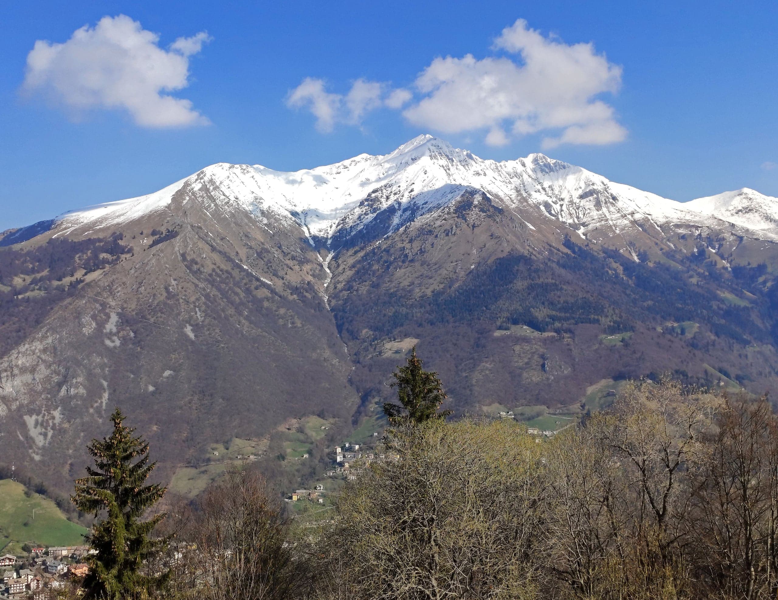
Cima di Menna, 2,300 m, from Zorzone on CAI trail 234: 1,250 m and 4 hours up through Val Carnera and the MAGA bivouac, with no water along the way.
Museums · 2 minutes
Museum of Minerals and Mining in Zorzone
Three floors on the zinc and lead mines of Oltre il Colle in Zorzone's old school: miners' tools, a rebuilt tunnel, local minerals and a 1944 memorial.
Churches · 1 minute
Church of the Santissima Trinità in Zorzone
Zorzone's parish church, a parish since 1636, rebuilt between 1745 and 1755 to a design by Giovan Battista Caniana: dome, stucco work and a canvas of 1628.
Villages · 2 minutes
Zorzone, the mining village
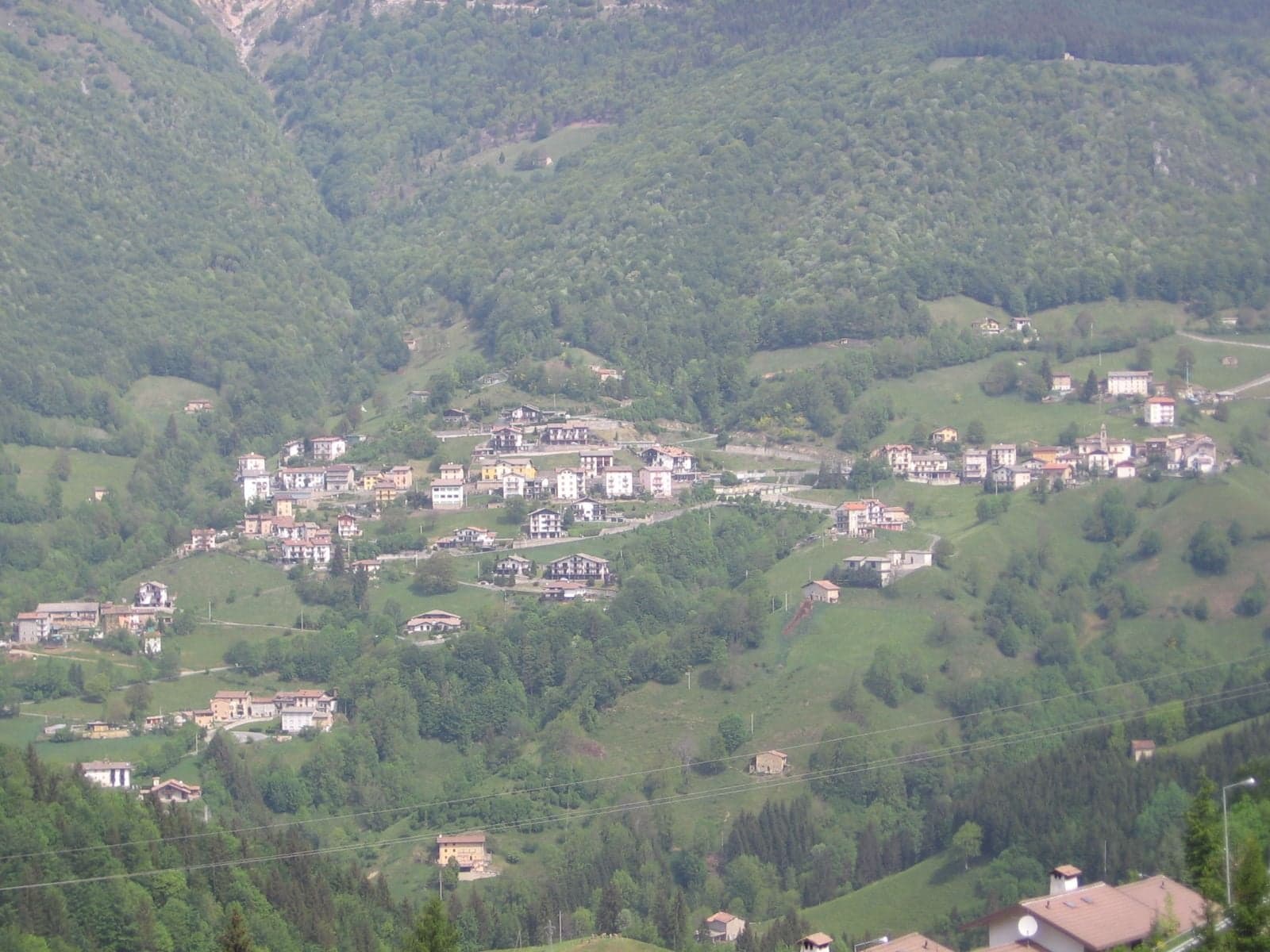
Zorzone, at 1,019 metres, is the hamlet of the Val Vedra zinc mines: Caniana's church, the mining museum, 23 frescoes on the houses and the trails to the Menna.