Hike · Zambla Alta · Oltre il Colle
Passo Branchino from Zambla Alta via the Capanna 2000
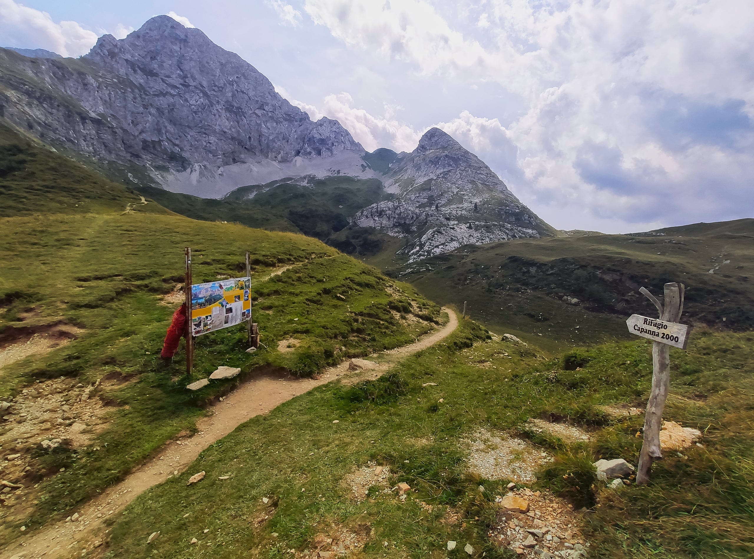
Passo Branchino (1,821 m) from Zambla Alta: CAI trail 221 to the Capanna 2000, then the 222 traverse below the Arera, with the lake just below the pass.
Notice
From 5 October to 18 December 2026, between 8.00 and 17.00, the Plassa–Alpe Arera road has temporary closures managed by flaggers during logging work at Grumello (mayor's order no. 39/2026, which may be extended): allow for waits, or walk up from Plassa.
The Passo Branchino, at 1,821 metres, is the broad saddle where the trails from the Capanna 2000, from the Val Vedra above Zorzone, from the Valcanale and from the Baite di Mezzeno meet; the lake lies just below, in a hollow between the Corno Branchino and the Corna Piana, on the boundary between Ardesio and Oltre il Colle (Wikipedia). It is one of the few lakes of the Orobie in an area of karstic limestone.
From Oltre il Colle there are two ways up. The busiest climbs from Zambla Alta to the Capanna 2000 on CAI trail 221 and continues on trail 222, which traverses below the Arera to the pass: in summer you can shorten it by driving up to the Alpe Arera car park, at about 1,600 metres. The other starts from Zorzone and climbs the whole Val Vedra on trail 231: 7.6 kilometres and 850 metres of ascent, 3 hours out.
At the pass you also meet trail 218, which drops to the Rifugio Lago Branchino and the Alpe Corte or climbs to the Corna Piana and the Mandrone along the Sentiero dei Fiori, and trail 219 to the Baite di Mezzeno, on the Roncobello side.
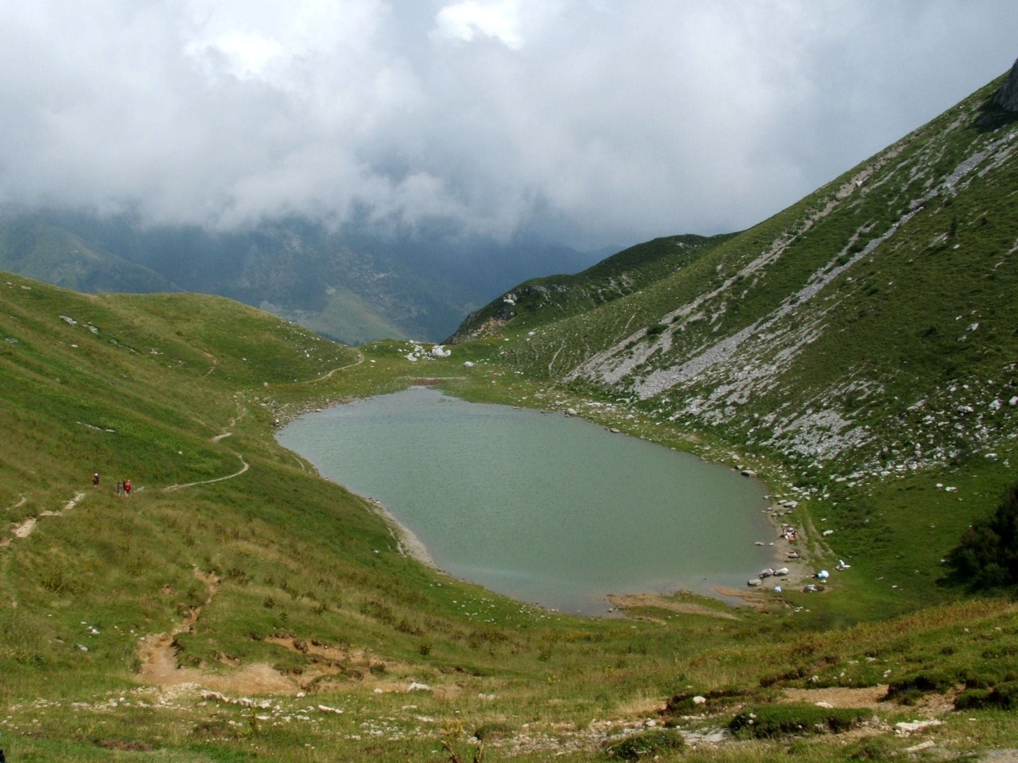
Photo: Luigi Chiesa · CC BY 3.0
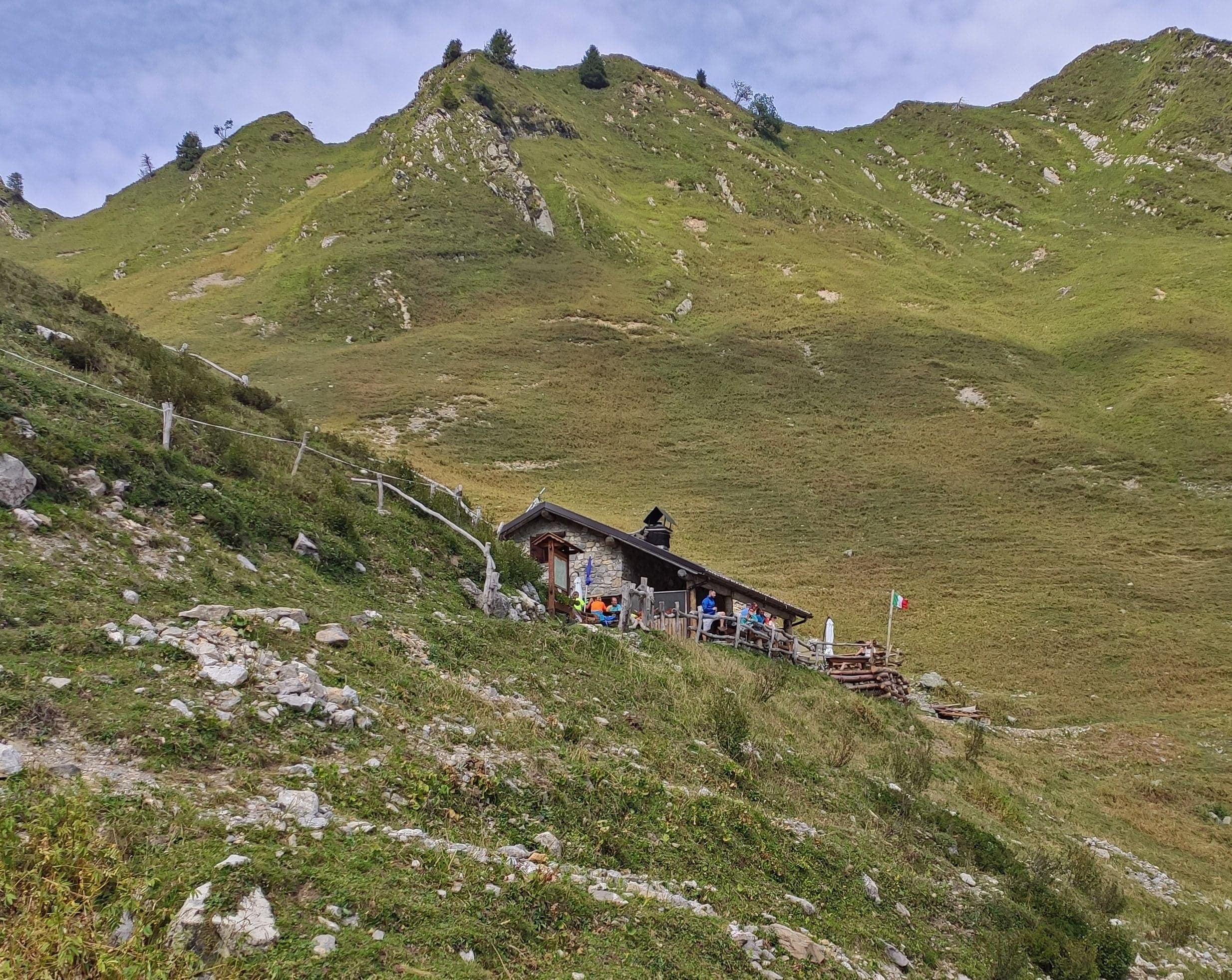
Photo: MatthewGhera · CC BY 3.0
From Zambla Alta via the Capanna 2000: the route
Trail 221 starts at Zambla Alta, at about 1,150 metres, and in winter follows the road that in about 4 kilometres reaches the start of the old ski lifts; from there it climbs north-west on the ridge overlooking the Val Vedra to the forest road, which soon leads to the Capanna 2000, at 1,960 metres (CAI Bergamo). The CAI gives 3.6 kilometres, about 900 metres of ascent and 1 hour 10 minutes; the Rifugi Lombardia portal estimates 1 hour 50 minutes from Zambla Alta instead.
In summer you can drive from Plassa up to the car park at 1,600 metres, below the old lifts (CAI Bergamo). Parking there is paid: 4 euros for any vehicle, with a ticket bought before driving up, in partner shops or at the Plassa parking meters opposite the apartment blocks, and left on display; the municipality also sells a 30-euro season pass. In winter the road is closed: in 2026 it reopened to traffic on 22 April (Comune di Oltre il Colle). Lower down, near the Camping Arera, at around 1,200 metres, there are free car parks (CAI Bergamo, Luca Gherardi). From the upper car park Rifugi Lombardia reckons an hour and 400 metres to the hut.
From the Capanna 2000, trail 222 drops briefly on 221 to the signpost at about 1,935 metres, then turns north, crosses the Val d'Arera and traverses towards the head of the Val Vedra with constant ups and downs. It comes out on the pastures of the Baita Branchino (1,836 m), where trail 231 arrives from Zorzone, and with a short descent and a short climb reaches the pass: 3.8 kilometres, 1 hour 15 minutes out and 1 hour 30 back, with about 100 metres of ascent and 200 of descent (CAI Bergamo).
From Zorzone up the Val Vedra: trail 231
From Zorzone, at 1,019 metres, a mule track heads east across the slope into the Val Vedra, which you climb at a moderate gradient to Pian Bracca (1,111 m), now the most common starting point because it can be reached by car from Zorzone. Keeping close to the valley floor you pass the Baita Pessel (1,209 m) and the pastures of the Casera di Vedro (1,672 m); with a last climb north you reach the Passo di Val Vedra (1,848 m) and straight after it the Passo Branchino (CAI Bergamo).
Trail 231 is 7.6 kilometres long, with 850 metres of ascent and 50 of descent: 3 hours out and 2 hours 10 back, grade E, season April to October. The CAI suggests parking in Zorzone in via Giorgi. It is also the descent of the Arera mountain-bike loop: in the Val Vedra you may meet cyclists (Percorsi MTB Val Brembana).
Lake Branchino and its hut
The lake lies at about 1,787 metres (OpenStreetMap), below the pass on the Valcanale side. The Rifugio Lago Branchino, the former Baita di Neel alta, stands north-east of the lake (CAI Bergamo) and is run by the A.R.D.E.S. association; for the 2026 season its blog announces opening on Saturdays and Sundays in September and October.
On the other side, the Capanna 2000 is the base for the climb from Zambla: Rifugi Lombardia points out that its opening dates are indicative and advises phoning at the start and end of the season. The number, 0345 95096, is also given by Percorsi MTB Val Brembana.
From the pass: Sentiero dei Fiori, Valcanale and Mezzeno
The Passo Branchino is a crossroads of trails and a stage of the most famous round in the area, the Sentiero dei Fiori: CAI Bergamo builds it from trail 222, the stretch of 218 from the pass to the Mandrone and part of 244 along the slopes of the Arera, grades it E and marks it with panels on the area's natural features; according to the Orobie Park the loop stays between 1,821 and 2,078 metres.
- CAI 218 southwards: up a scree slope to the Bocchetta di Corna Piana (2,078 m) and the Passo di Corna Piana (2,133 m), and from the Mandrone junction on trail 244 to the Passo Gabbia and the Capanna 2000: this is the Sentiero dei Fiori walked the other way round. The full circuit of the Arera, which stays on 244 and crosses the Forcola di Valmora, is a different matter: it is graded EE, and since 31 May 2026 the CAI has reported some chain anchors detached below the col.
- CAI 218 northwards: to the Rifugio Lago Branchino, the huts of the Alpe di Neel and the Rifugio Alpe Corte (1,415 m), down to Valcanale, where parking is paid.
- CAI 219, the Sentiero delle Farfalle: 2.6 km and 240 m of ascent to the Baite di Mezzeno (50 min up, 40 min down). The Capovalle-Mezzeno municipal road in Roncobello is a toll road, with April 2025 rates of 3 euros a day and a parking meter that gives no change (CAI Bergamo).
When to go and what to know
For all these trails the CAI recommends April to October, with boots and high-mountain clothing. Trail 222 faces north: after snowy winters or late in autumn the traverse below the Arera is the stretch to assess most carefully.
Water and food are available at the huts, the Capanna 2000 and the Lago Branchino, during their opening periods: the massif is limestone and karstic (Wikipedia) and the descriptions mention no springs along trail 222.
In detail
Routes to the Passo Branchino from Oltre il Colle
| Route | Trails | Ascent | Times |
|---|---|---|---|
| From Zambla Alta via the Capanna 2000 | CAI 221, then 222 | About 900 m on 221, then +100 and −200 m on 222 | 1 h 10 (CAI) or 1 h 50 (Rifugi Lombardia) to the Capanna, then 1 h 15 |
| From the upper Alpe Arera car park | Forest road or 221, then 222 | About 400 m to the Capanna | 1 h to the Capanna (Rifugi Lombardia), then 1 h 15 |
| From Zorzone up the Val Vedra | CAI 231 | 850 m up, 50 m down | 3 h out, 2 h 10 back |
Data from the CAI Bergamo geoportal unless stated otherwise. The return on 222 from the pass to the Capanna 2000 takes 1 h 30.
Waypoints on trail 231
| Point | Altitude |
|---|---|
| Zorzone | 1,019 m |
| Pian Bracca | 1,111 m |
| Baita Pessel | 1,209 m |
| Casera di Vedro | 1,672 m |
| Passo di Val Vedra | 1,848 m |
| Passo Branchino | 1,821 m |
Altitudes from the trail 231 page of the CAI Bergamo geoportal.
Practical tips
Before you set off
- Driving up to the upper Alpe Arera car park saves about 400 metres: buy the ticket before driving up, at the Plassa parking meters or in partner shops.
- The 222 traverse faces north: after snowy winters ask at the Capanna 2000 before setting off.
- Fill your bottles at the huts: the descriptions mention no springs along trail 222.
- If you descend to Valcanale or Mezzeno, arrange to collect your car from the other side.
- Trail 231 in the Val Vedra is also ridden by mountain bikers: give way to riders coming down.
Grade E. E, Hiker: marked paths or tracks over varied terrain; requires fitness and proper footwear.
FAQ
Frequently asked questions: Passo Branchino from Zambla Alta via the Capanna 2000
Can you reach Lake Branchino starting from Zambla?
Yes, via the Capanna 2000. CAI trail 221 climbs from Zambla Alta (1,150 m) to the hut in 3.6 kilometres and about 900 metres of ascent, then trail 222 traverses the Val d'Arera to the Passo Branchino (1,821 m) in 3.8 kilometres and 1 hour 15 minutes, past the Baita Branchino; the lake is just below the pass.
How long does it take from the Capanna 2000 to the Passo Branchino?
CAI Bergamo gives 1 hour 15 minutes out and 1 hour 30 back on trail 222, with about 100 metres of ascent and 200 of descent: the route stays almost level between 1,821 and 1,960 metres. The grade is E.
Is there a trail to the Passo Branchino from Zorzone?
Yes, CAI 231 climbs the whole Val Vedra: 7.6 kilometres, 850 metres of ascent, 3 hours out and 2 hours 10 back, past Pian Bracca, the Baita Pessel and the Casera di Vedro. Pian Bracca can also be reached by car from Zorzone.
Is the road to the Alpe Arera a toll road?
The car park at 1,600 metres, at the top of the road from Plassa, is paid: 4 euros for any vehicle, with a ticket bought before driving up at the Plassa parking meters or in partner shops, or a 30-euro season pass (Comune di Oltre il Colle, April 2026). In winter the road is closed; lower down, near the Camping Arera, there are free car parks.
Is the Rifugio Lago Branchino open?
For the 2026 season the hut's blog announces opening on Saturdays and Sundays in September and October. The hut, the former Baita di Neel alta, stands north-east of the lake at 1,787 metres according to the CAI and is run by the A.R.D.E.S. association.
Can you do the Sentiero dei Fiori round via the Branchino?
Yes: CAI Bergamo's Sentiero dei Fiori links trail 222 from the Capanna 2000 to the Passo Branchino, trail 218 from the pass to the Mandrone via the Bocchetta di Corna Piana and part of trail 244 back to the hut over the Passo Gabbia. The CAI grades it E, the Orobie Park places it between 1,821 and 2,078 metres and the hut's page on the regional portal reckons about 3 hours. Only the full circuit on trail 244 is EE.
Is Lake Branchino in the municipality of Oltre il Colle?
It lies on the administrative boundary between Ardesio and Oltre il Colle, in a hollow between the Corno Branchino and the Corna Piana (Wikipedia). One of the two trails up to it, trail 231, starts from Zorzone in Oltre il Colle.
Can you go down from the Passo Branchino to the Baite di Mezzeno?
Yes, on CAI trail 219, the Sentiero delle Farfalle: 2.6 kilometres and 240 metres of height difference, 40 minutes down and 50 up. The Baite di Mezzeno are on the Roncobello side, and the Capovalle-Mezzeno municipal road is a toll road.
Sources
- Comune di Oltre il Colle – ordinanza del sindaco n. 39/2026, chiusure temporanee con movieri della strada Plassa/Arera 1600 dal 5 ottobre al 18 dicembre 2026 · www.comune.oltreilcolle.bg.it · accessed on 1 October 2026
- CAI Bergamo, geoportale – sentiero 221 Zambla / Rifugio Capanna 2000 · www.caibergamo.it · accessed on 1 October 2026
- CAI Bergamo, geoportale – sentiero 222 Rifugio Capanna 2000 / Passo Branchino · www.caibergamo.it · accessed on 1 October 2026
- CAI Bergamo, geoportale – sentiero 231 Zorzone / Passo Branchino · www.caibergamo.it · accessed on 1 October 2026
- CAI Bergamo, geoportale – sentiero 218 Rifugio Alpe Corte / Baita GAN · www.caibergamo.it · accessed on 1 October 2026
- CAI Bergamo, geoportale – sentiero 219 Baite di Mezzeno / Passo Branchino · www.caibergamo.it · accessed on 1 October 2026
- CAI Bergamo, geoportale – sentiero 244 periplo del Pizzo Arera (avviso del 31 maggio 2026) · www.caibergamo.it · accessed on 1 October 2026
- CAI Bergamo, geoportale – itinerario Sentiero dei fiori · www.caibergamo.it · accessed on 1 October 2026
- CAI Bergamo, geoportale – Rifugio Branchino · www.caibergamo.it · accessed on 1 October 2026
- Rifugi Lombardia – Rifugio Capanna 2000, accessi e apertura · www.rifugi.lombardia.it · accessed on 1 October 2026
- Rifugio Lago Branchino – blog, stagione 2026 · rifugiobranchino.blogspot.com · accessed on 1 October 2026
- Wikipedia – Lago Branchino · it.wikipedia.org · accessed on 1 October 2026
- Luca Gherardi – Pizzo Arera da Zambla (parcheggi e ticket della strada) · lucagherardi.com · accessed on 1 October 2026
- Comune di Oltre il Colle – riapertura della strada Plassa-Arera 1600 e parcheggio a pagamento (21 aprile 2026) · www.comune.oltreilcolle.bg.it · accessed on 1 October 2026
- Rifugi di Lombardia – Rifugio Capanna 2000, escursioni dal rifugio (Sentiero dei Fiori, circa 3 ore) · www.rifugi.lombardia.it · accessed on 1 October 2026
- Parks.it – Parco delle Orobie Bergamasche, Sentiero dei Fiori e delle Farfalle (quote dell'anello) · www.parks.it · accessed on 1 October 2026
- OpenStreetMap – Passo del Branchino (quota 1.821 m) · www.openstreetmap.org · accessed on 1 October 2026
- Percorsi MTB Val Brembana – Oltre il Colle, Capanna 2000, Sentiero dei Fiori, Val Vedra · www.percorsimtbvalbrembana.it · accessed on 1 October 2026
- OpenStreetMap – Passo del Branchino, lago e parcheggio dell'Alpe Arera · www.openstreetmap.org · accessed on 1 October 2026
Page verified on
Nearby
More pages from around here
Hikes · 2 minutes
Sentiero dei Fiori “Claudio Brissoni”
Sentiero dei Fiori Claudio Brissoni: a CAI loop of about 3 hours from the Capanna 2000 to Passo Branchino, 1,821–2,078 m, on the flowering slopes of the Arera.
Summits · 2 minutes
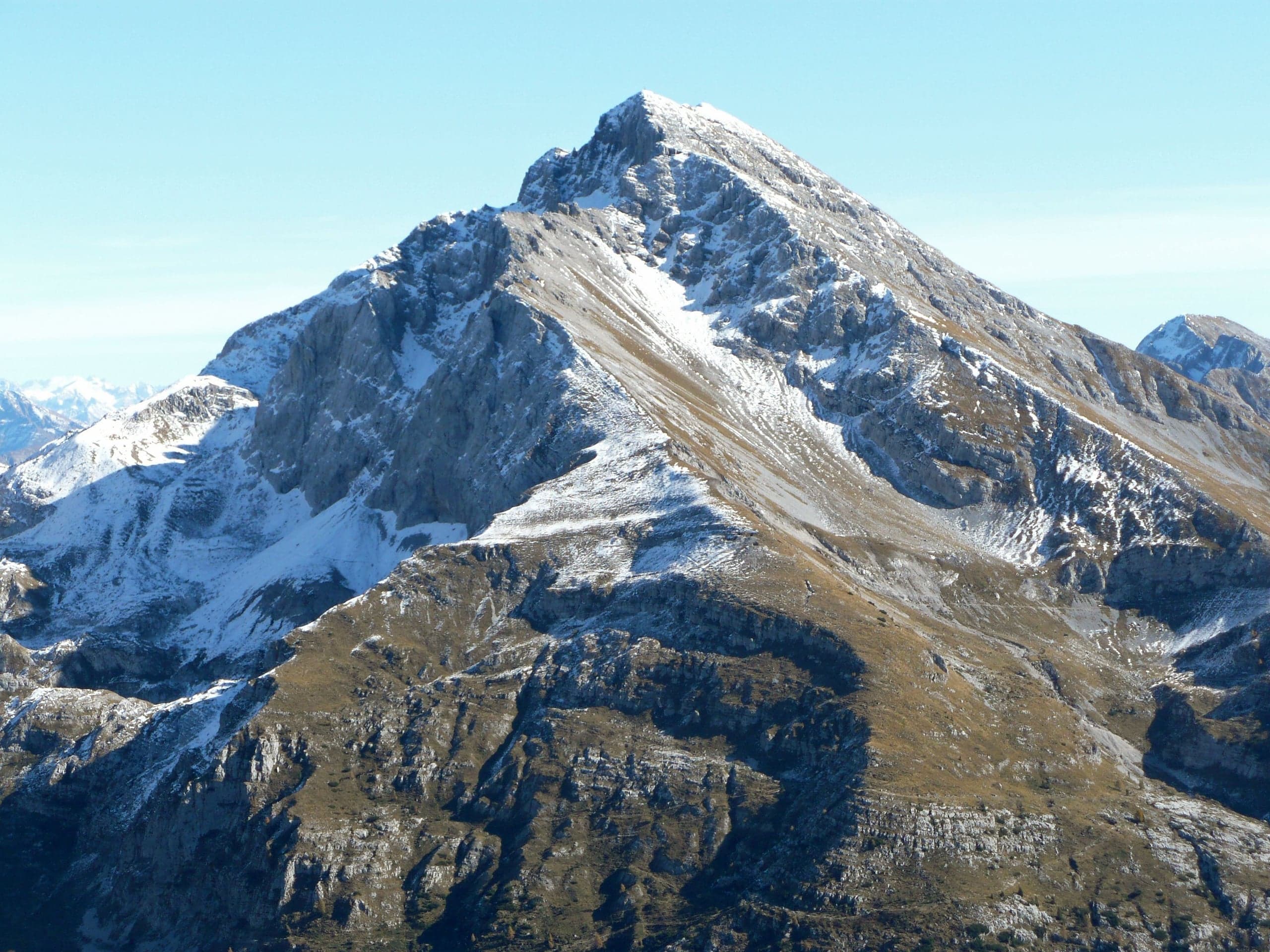
Pizzo Arera (2,512 m) by the south normal route
Pizzo Arera, 2,512 m, by the south normal route: from the Alpe Arera car park 922 m of ascent and about 2 h 30, with a protected gully just below the summit.
Summits · 2 minutes
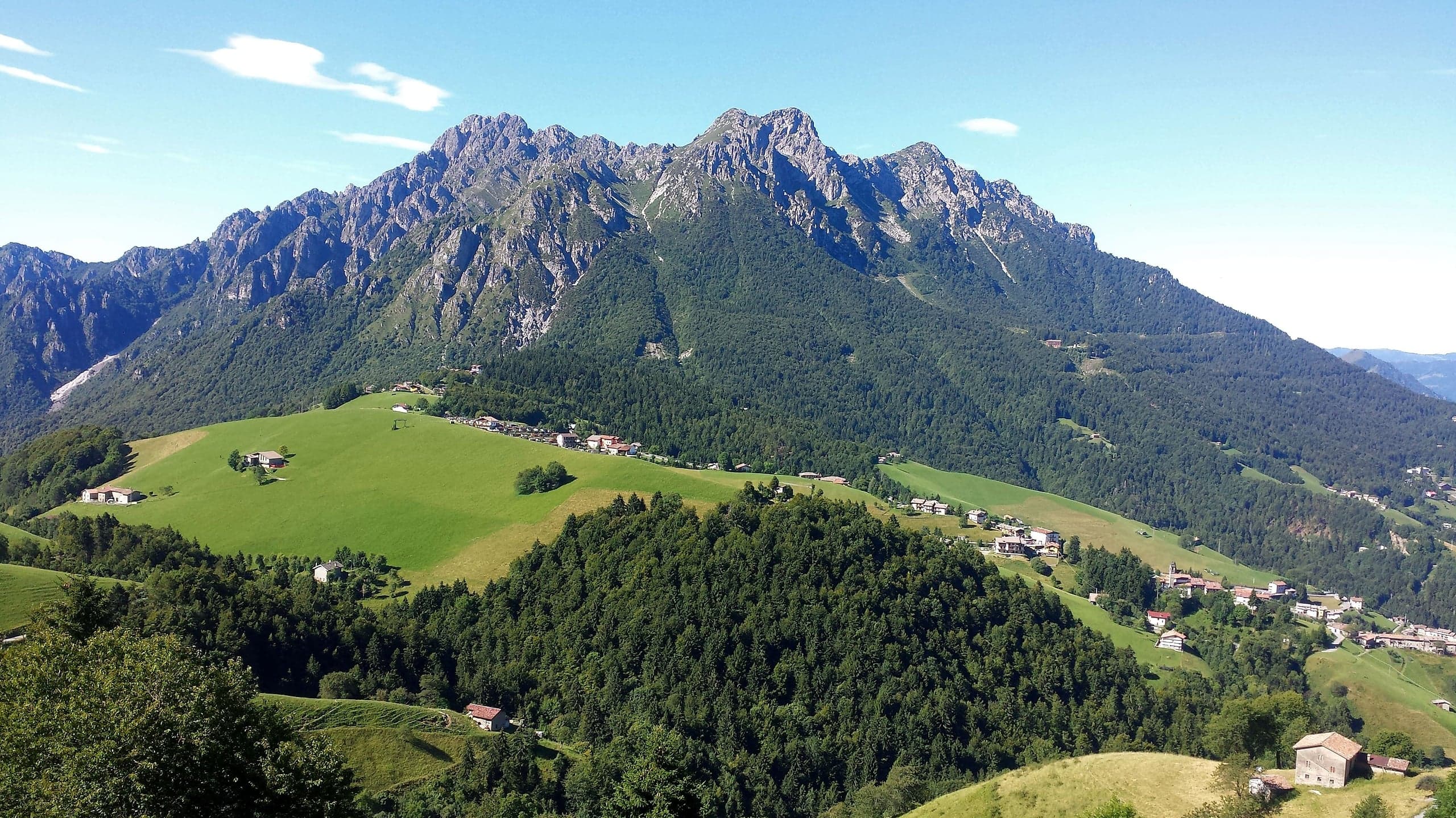
Monte Alben (2,019 m) from the Colle di Zambla
Monte Alben, 2,019 m, from the Colle di Zambla on CAI trail 501: 750 m and 2 h 15 via the Col dei Brassamonti, Passo della Forca and the final EE ridge.
Mountain huts · 2 minutes
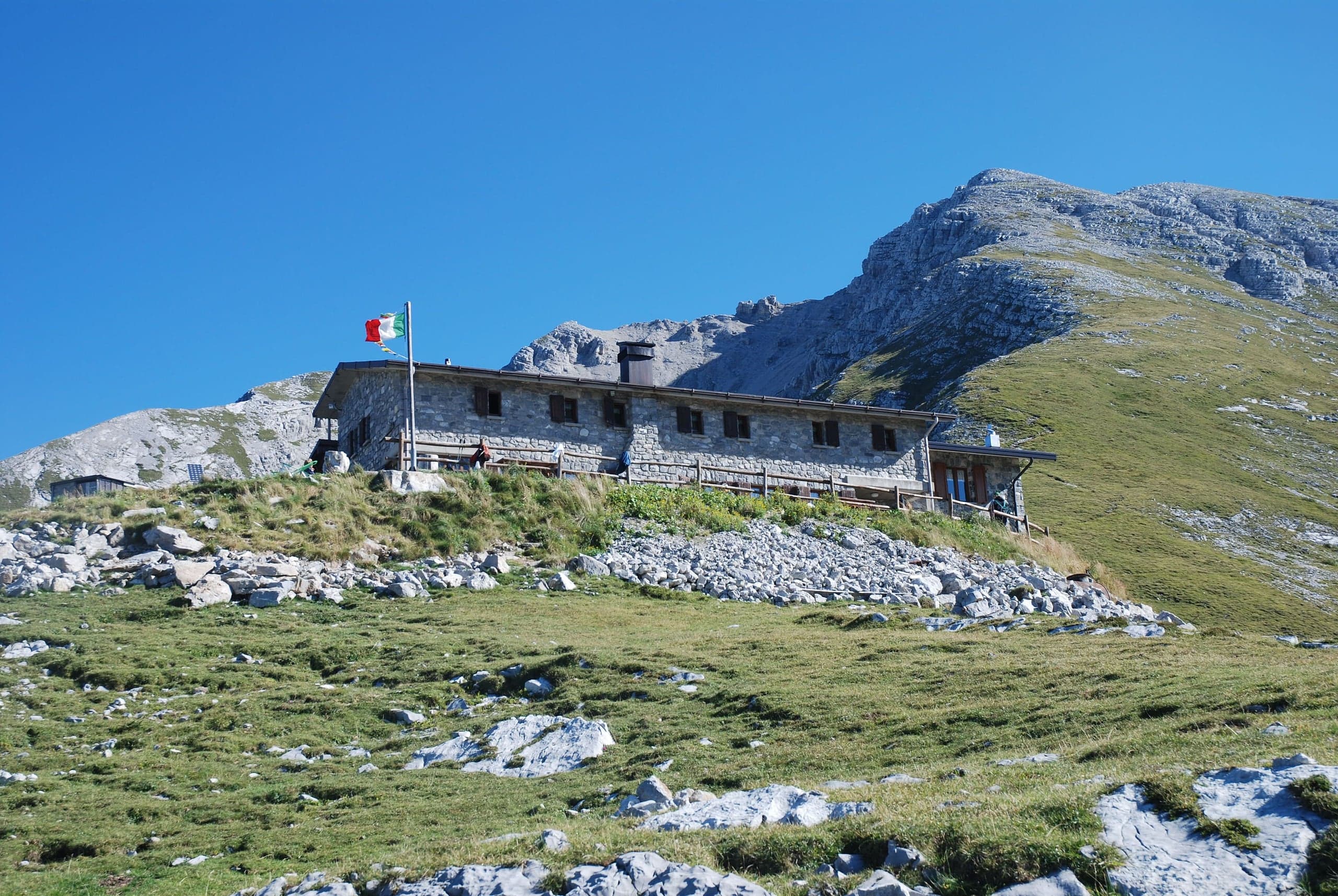
Capanna 2000 hut
Capanna 2000 hut, 1,960 m below the Pizzo Arera: owned by Oltre il Colle, 25 beds, an hour from the Alpe Arera car park. Opening periods, booking and contacts.